51 F. high on Wednesday in the Twin Cities.
36 F. average high on November 25.
24 F. high on November 25, 2014.
8.9 F. November in the Twin Cities is running nearly 9 degrees warmer than average, to date.
November 26, 2001: A strong low pressure system develops in Colorado on the 25th, reached eastern Iowa during the evening of the 26th, then moved into eastern Wisconsin late on the 27th. It produced a wide swath of heavy snow across much of central Minnesota into West Central Wisconsin. Storm total snowfall of 8 inches or more was common, with a large area exceeding 20 inches. Specifically, Willmar picked up 30.4 inches, New London saw 28.5 inches, Collegeville had 23.4 inches, Litchfield and Granite Falls received 22 inches, and Milan had 20 inches. A convective snow band set up across this area on the 27th and remained nearly stationary for over 12 hours, resulting in the extreme storm totals. From 8 am on the 26th to 8 am on the 27th, Willmar received 21 of its 30.4 inches, setting a record for most snowfall in Willmar in a 24 hour period. The heavy wet snow downed numerous power lines, and at one point, at least 20,000 customers were without power in the Minneapolis-St. Paul metropolitan area. Over one thousand traffic accidents were noted across the entire area. Most were minor, but one accident claimed two lives when a car spun out and collided with a semi near Mora.
November 26, 1995: A narrow band of five to eight inches of snow falls from west central Minnesota around Canby and Granite Falls to east central Minnesota. This included much of the Twin Cities metro area.
November 26, 1965: A snowstorm develops across northern Minnesota. 14.7 inches of snow fell at Duluth, along with 13.6 inches at Grand Rapids.
November 26, 1896: A severe Thanksgiving day ice storm develops over southwest and central Minnesota. 1.42 inches of freezing rain falls at Bird Island, and 1.20 inches of freezing rain falls at Montevideo. The ice causes a great deal of damage to trees and shrubs. Source for historical weather data: NOAA.

A Thanksgiving Brush With Slush; Sloppy Coating to 1″
“If the only prayer you said in your whole life was “thank you” that would suffice” wrote Meister Eckhart.
My wife and I just returned from the Middle East: Israel, the West Bank, Jordan and Dubai, which is a blend of Las Vegas, New York and Disneyworld. We saw Syrian refugee settlements in Amman, Jordan and heard some heartbreaking stories. After a trip like that you return with new eyes, and a heightened sense of gratitude.
In what may be an omen of a “stunted winter” to come today’s storm (it hardly fits the definition) tracks south of MSP. A couple inches of slush may fall on Mankato and Rochester, a coating to an inch for the metro, with most roads staying wet. No. Big. Deal.
El Nino winters tend to be milder, with a majority of the biggest storms tracking south of Minnesota. We’ll see snow and cold, but probably not in the volume we’re all accustomed to.
Expect dry roads and chilled sunshine Friday and Saturday; the next chance of light flurries late Sunday. Long range models show a relatively mild, Pacific wind flow returning by mid-December.
The WMO says 2011-2015 was the warmest 5 year period on record, worldwide. Details below. A happy and safe Thanksgiving to you and yours.
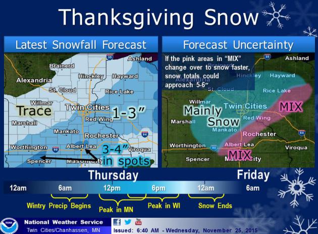
Nuisance Snow. Based on the latest guidance I’m thinking a coating to 1″ in the metro (best chance of an inch from Shakopee to Eagan, maybe a couple inches from Northfield to Hastings. With daytime temperatures near freezing major roads and freeways should be mostly-wet, but early morning and evening conditions may be slippery, especially south and east of the Twin Cities. Map source: Twin Cities National Weather Service.
Narrow Stripe of Accumulating Snow. NAM guidance shows an inch or two of slushy snow from Fairmont and Albert Lea to Owatonna and Red Wing, maybe as much as 3″ of sloppy snow in a few spots, the best chance of accumulating snow late afternoon and evening as we lose daylight and meager radiational heating. Source: NOAA and AerisWeather.
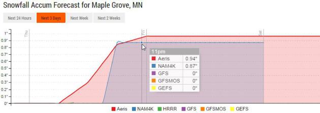
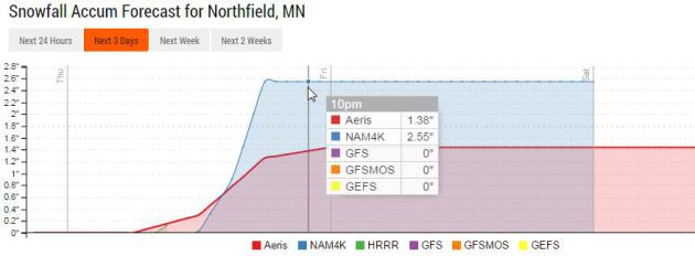
More Snow South of MSP. Models print out just under an inch for Maple Grove and northern suburbs, closer to 2″ or more near Northfield, enough to temporarily cover up those unnaturally green lawns. Graph: Aeris Enterprise.
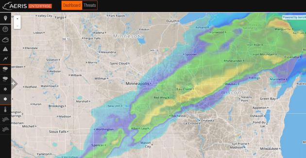
Thanksgiving Slush. Models show the best chance of 2-3″ of snow from near Albert Lea to Red Wing and Eau Claire; amounts dropping off rapidly as you head north and west of the Twin Cities.
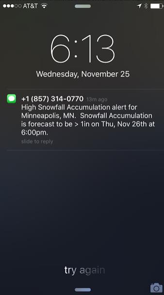
Risk of an Inch. At the rate we’re going an inch of slush may be a big deal, especially at rush hour, especially with temperatures colder than 20F. Our internal models suggest an inch of slush at MSP by 6 PM this evening. Source: Aeris Enterprise Mobile.
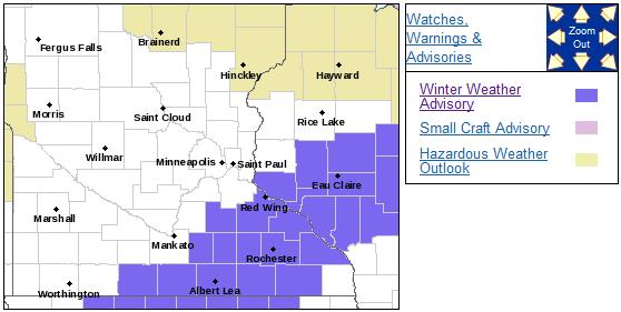
Winter Weather Advisory. Roads may be slushy and icy, especially south and east of Minneapolis and St. Paul, with a mix of wet snow and freezing drizzle. Details from the Twin Cities Weather Service:
A WINTER WEATHER ADVISORY HAS BEEN ISSUED FOR PARTS OF SOUTH
CENTRAL AND SOUTHEAST MINNESOTA...AS WELL AS WEST CENTRAL
WISCONSIN FROM 6 AM TO 9 PM THANKSGIVING DAY. THIS ADVISORY IS
MAINLY SOUTHEAST OF A LINE FROM FAIRMONT TO RED WIND
MINNESOTA...TO MENOMONIE AND LADYSMITH WISCONSIN. A MIXTURE OF
SLEET...FREEZING DRIZZLE OR FREEZING RAIN WILL DEVELOP THURSDAY
MORNING...BEFORE MIXING AND CHANGING OVER TO SNOW BY THE
AFTERNOON. THERE COULD BE A PERIOD OF MODERATE SNOWFALL DURING THE
AFTERNOON ONCE THE PRECIPITATION CHANGES OVER TO ALL SNOW. A QUICK
1 TO 3 INCHES WILL OCCUR IN THE ADVISORY AREA WITH A LIGHT COATING
OF ICE...BUT THIS SHOULD BE CONFINED TO ELEVATED OBJECTS...BRIDGES
AND OVERPASSES.
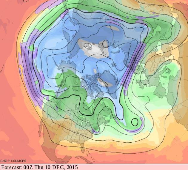
Zonal Flow Lingers into Mid-December. Despite a cooling trend into the weekend and early next week the flow aloft is predominately west to east, with very little cold air available to tap across Canada into the second week of December. We may see a series of nuisance snows, but no big dumpings are imminent.
One of the 3 Warmest Novembers in Recorded Minnesota History? That’s according to climate guru Mark Seeley; here’s an excerpt from this week’s edition of Minnesota WeatherTalk: “Through the first 25 days of November temperatures have been averaging well above normal. It is likely that this month will conclude in a manner that will rank it among the top three warmest Novembers in Minnesota history, likely falling short of the warmest ever which occurred in 2001. Over 40 communities reported at least one day this month with an afternoon temperature of 70°F or higher. In all 33 new daily maximum temperature records were set within the National Weather Service Cooperative Observer Network in Minnesota, and 145 daily warm minimum temperature records were set, a remarkably large number. No low temperature records were set anywhere in the state this month...”
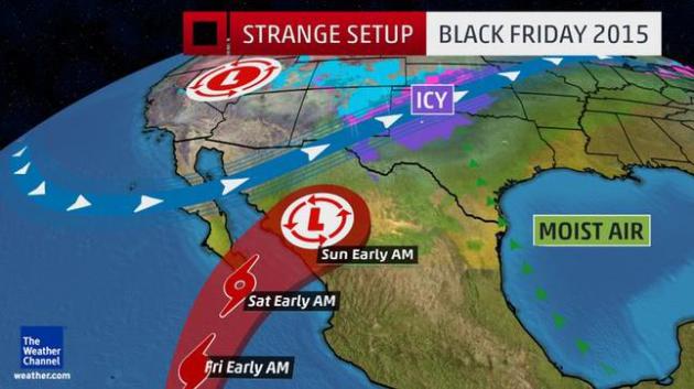
Bizarre Thanksgiving Weekend: Ice Storm and a Hurricane. Here’s an excerpt from The Weather Channel that caught my eye: “…There have been only three other eastern Pacific storms of record dating to 1949 that formed later in the season than Sandra did on November 24. Sandra is the latest storm in the eastern Pacific since Hurricane Winnie was a December oddball in 1983. El Niño seasons such as the one we’re currently in typically feature lower wind shear over the eastern Pacific basin, which otherwise rips developing or active tropical cyclones apart. Sandra formed in a relatively small window of lower wind shear, and also capitalized on water temperatures from 1 to 1.5 degrees Celsius above average to fuel its convection…”
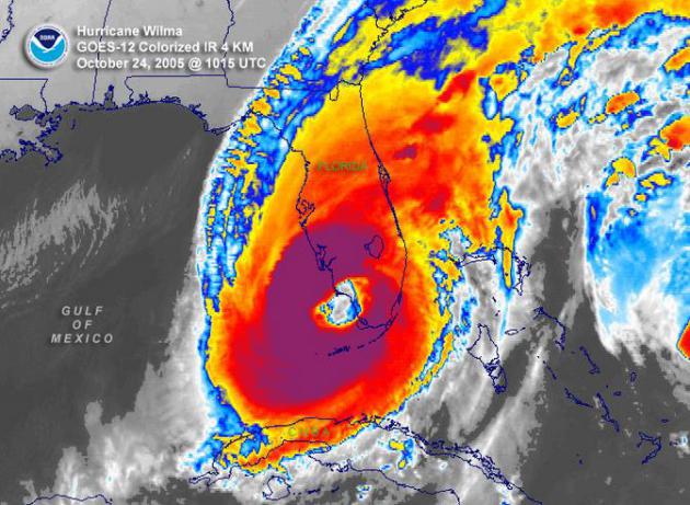
NOAA: Record 121 Months Since Last Major Hurricane Hit USA. A major hurricane is defined as Category 3 or stronger. Here’s a clip from a story at cnsnews.com: “It has now been a record 121 months since the last major hurricane made landfall in the continental United States, according to National Oceanic and Atmospheric Administration (NOAA) statistics. The last major hurricane to make landfall on the continental United States was Hurricane Wilma, which slammed into Florida on October 24, 2005. NOAA’s Hurricane Research Division has published data on the hurricanes that have struck the U.S. going back to 1851. Hurricane season will officially end on November 30. President Obama is the longest-serving president during the period for which NOAA has data to have no major hurricane strike during his time in office…” (Hurricane Wilma file image: NOAA)
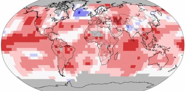
2015: Hottest Year Worldwide Since Records Started in 1880. Unless another “polar vortex” sets up in the coming weeks (unlikely) 2015 will be even warmer than the previous record: 2014. 14 of the 15 warmest years, worldwide, have occurred since 2000. Here’s an excerpt from US News: “…Scientists at the U.S. National Oceanic and Atmospheric Administration and elsewhere already were saying that 2015 likely would be the hottest. The U.N. agency, NOAA, NASA and Japan’s weather agency all say 2014 is the current record hot year with a global temperature of 14.57 degrees Celsius, 58.23 degrees F. “I would call it certain,” NOAA’s chief climate monitor, Deke Arndt, said on Tuesday. “Something game-changing massive would have to happen for it not to be a record.” Records go back to 1880. Jarraud also said it is likely that the world has now warmed by 1 degree Celsius, or 1.8 degrees Fahrenheit, over pre-industrial times. That’s a symbolic milestone: International leaders have set a goal of keeping global warming within 2 degrees C, 3.6 F, of pre-industrial times...”
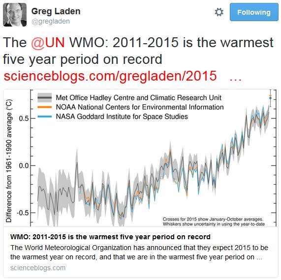
World Meteorological Organization: 2015 Like to be Warmest on Record; 2011-2015 Warmest Five-Year Period. Here’s an excerpt from a WMO press release: “The global average surface temperature in 2015 is likely to be the warmest on record and to reach the symbolic and significant milestone of 1° Celsius above the pre-industrial era. This is due to a combination of a strong El Niño and human-induced global warming, according to the World Meteorological Organization (WMO). The years 2011-2015 have been the warmest five-year period on record, with many extreme weather events – especially heatwaves – influenced by climate change, according to a WMO five-year analysis...”

U.N. Report on Extreme Weather Trends. Here’s an excerpt from the study released by The United Nations Office for Disaster Risk Reduction that caught my eye: “…Asia accounts for the lion’s share of disaster impacts including 332,000 deaths and 3.7 billion people affected. The death toll in Asia included 138,000 deaths caused by Cyclone Nargis which struck Myanmar in 2008. In total, an average of 335 weather-related disasters were recorded per year between 2005 and 2014, an increase of 14% from 1995-2004, and almost twice the level recorded during 1985-1995.…”
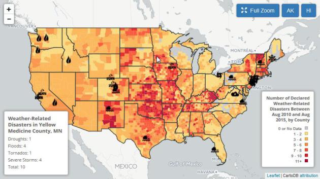
Unprecedented. 96% of American Counties Have Recently Seen a Weather Extreme. Here’s an excerpt from Environment America and Climate Denial Crock of the Week: “One reason that polls have been swinging away from climate denial and toward the need for action on climate, is that more and more Americans have witnessed first hand an event that they find far enough out of the ordinary so as to be convincing. Environment America: Ninety-six percent of Americans live in a county hit by at least one weather-related disaster in the last five years, according to a new interactive map using federal government data. Scientists say global warming is already exacerbating some extreme weather events and their impacts…”
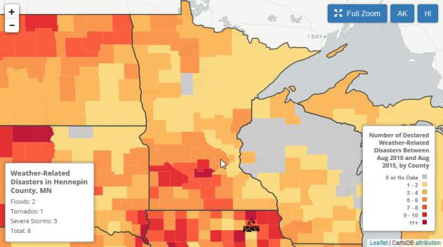
Drilling Down: Weather-Related Weather Disasters in Minnesota. Hennepin County has experienced 6 weather-related disasters since August, 2010, while Sibley County has experienced 11. Check out the interactive map from Environment America.

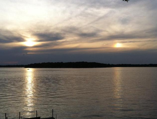
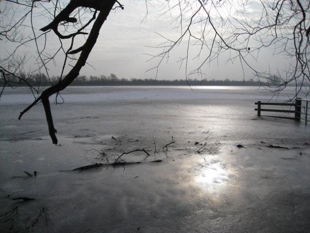
More Severe Storms Are Throwing Off Bird Migration. Atlas Obscura has an interesting symptom of changing weather patterns; here’s an excerpt: “...If it wasn’t already enough to fly thousands of miles—44,000 round trip, if you’re the Arctic tern—birds of all shapes, sizes, and flying styles are now facing increasing obstacles to migration. Warmer weather is shepherding in shorter winters and angrier storms, and there’s recently been an upsurge in the frequency and intensity of hurricanes. With shrinking winters affecting birds’ migration schedules, which start as early as June or as late as December, many birds find themselves awing during peak Atlantic hurricane season…”
Photo credit above: “Ominous skies don’t bode well for migrating birds.” (Photo: Unsplash/pixabay)
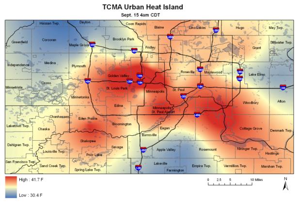
New Urban Heat Island Study Shows Surprising Variations in Air Temperatures Across the Twin Cities. Meteorologists have been tracking this effect for a long time, and in certain cases it can make the difference between rain, slush or snow. Here’s a clip from ScienceDaily: “…Recording surface air temperatures every 15 minutes from August 2011 through August 2014 across nearly 2,000 square miles and using U.S. Geological Survey data to fine-tune differences at the neighborhood level, the study uncovered several surprises. Among them: Temperatures in the urban core of Minneapolis, St. Paul and Bloomington average 2 °F higher in summer than in surrounding areas The differential spiked as much as 9 °F higher during a heat wave in July 2012 Urban heat island effect is stronger at night in summer and during the day in winter…” (Image credit: Star Tribune).
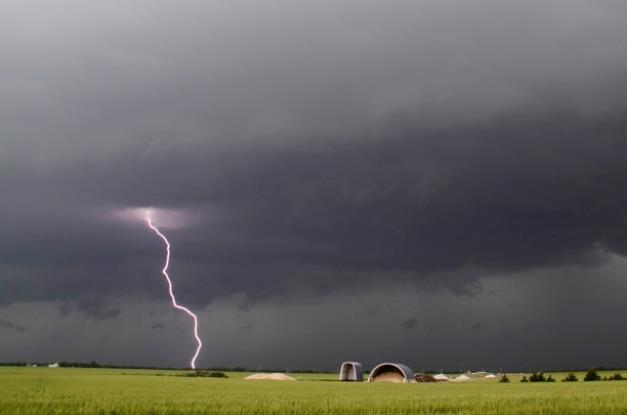
Supercomputers, Tornadoes, and the Biggest Unsolved Mystery in Weather Technology? Tornado warnings or “alerts” hours in advance? I wouldn’t rule it out in our lifetime, certainly our kid’s lifetimes. Here’s an excerpt of an interesting article at The Atlantic: “…There are some technologies that can help. A specific radar signature called a “debris ball,” for example, suggests that there is debris in the air from a tornado having wrecked something. Some researchers believe improvements in radar could eventually mean reliable tornado warnings up to an hour ahead of time. Vaccaro says he can imagine even longer lead-time, given enough observational data and the processing power from supercomputers to analyze it. Computers already process trillions of weather-related data points per second, which is a large part of why long-term forecasting accuracy, in general, is so much better today than it was even a decade ago...”
Photo credit above: “Lightning from a tornadic thunderstorm strikes a field near Clearwater, Kansas, in 2013.” Gene Blevins / Reuters.
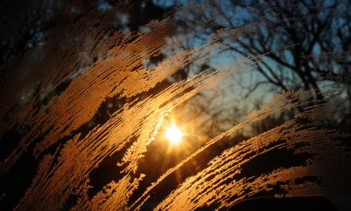
10 Things Everyone Should Know About Seasonal Affective Disorder. “SAD” is very real for many people; the dark days of winter can take a mental and physical toll. Here’s a snippet of a helpful article at Huffington Post: “…In most cases, SAD is just a seasonal component of clinical depression or bipolar disorder, according to Michelle Riba, a professor of psychiatry and the associate director of the University of Michigan Depression Center. “For people who see a regular pattern every year of getting sad, anxious or a cycling of moods, the first thing they need to do is to see someone to get an overall diagnosis,” she said. “They need to treat the underlying depression…”
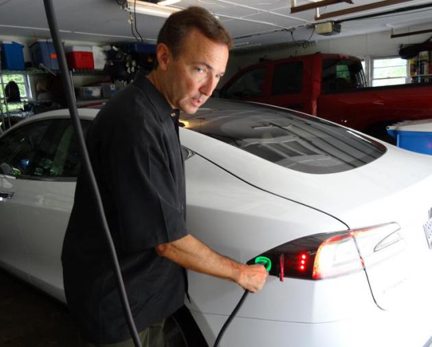
A Car Dealers Won’t Sell: It’s Electric. The reasons many car dealers aren’t more enthusiastic? Hard to say, but when in doubt follow the money. And yes, that’s a RAM 1500 truck in my garage (which I love). The day Dodge, Ford or Tesla makes an all-electric pick-up truck with a 300-500 mile range I’ll be one of the first to put down a deposit. Here’s an excerpt from an article at The New York Times: “…Industry insiders and those who follow the business closely say that dealers may also be worrying about their bottom lines. They assert that electric vehicles do not offer dealers the same profits as gas-powered cars. They take more time to sell because of the explaining required, which hurts overall sales and commissions. Electric vehicles also may require less maintenance, undermining the biggest source of dealer profits — their service departments…”

I Worked in a Video Store for 25 Years. Here’s What I Learned as my Industry Died. Such is the nature of disruption – I have (mostly) fond memories of the local video store too. Here’s a clip from Vox: “The independent video store where I’ve worked for 15 years is finally dead. After 28 years in business, we succumbed to the “disruption” of Netflix and Hulu, bled to death by the long, slow defection of our customer base. Once we announced our closing, the few who remained mourned — then we locked the doors. Our permanent collection is gone: boxed up and shipped off to the local library...”
THANKSGIVING DAY: Cloud with a slushy coating of snow possible; maybe 1″ by early tonight. Winds: N 10-15. High: 33
THURSDAY NIGHT: Flurries taper, some slick roads, especially south/east of MSP. Low: 22
FRIDAY: Chilled sunshine, risk of shopping. Winds: N 8-13. High: 32
SATURDAY: Blue sky, light winds, heavy jackets. Winds: SW 5-10. Wake-up: 18. High: 36
SUNDAY: Clouds increase, chance of light snow or flurries PM hours. Winds: W 7-12. Wake-up: 23. High: 37
MONDAY: Mostly cloudy, few flurries. Wake-up: 28. high: 35
TUESDAY: Mostly cloudy, chill in the air. Wake-up: 27. High: 34
WEDNESDAY: More sun, thawing out a little. Wake-up: 24. High: 39
Climate Stories…
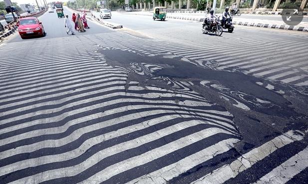
Study Drives a Nail into the Global Warming “Pause” Myth. Here’s the introduction to a recap at The Guardian: “Despite the organization and funding behind groups which try to cast doubt about the causes and implications of climate change, the facts have spoken. The world continues to warm and their favorite myths have died. We know that human-emitted heat-trapping gases warm the planet. In fact, this has been known for well over a century. With modern instruments (like ocean thermometers and satellites among others) we are now measuring the change. With advanced climate models, we can predict the changes. The measurements and the predictions are in excellent agreement, despite what cable news and second-rate skeptical scientists say…”
Photo credit above: “Road markings appear distorted during a heatwave, in New Delhi, India, 27 May 2015.” Photograph: Harish Tyagi/EPA.
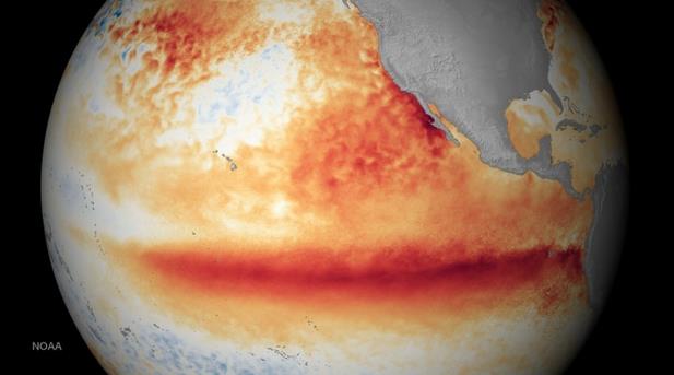
New Study Finds No “Substantive Evidence” of a Global Warming “Pause”. Chris Mooney reports on a new study that confirms there never was a warming hiatus – the warming is uneven but NASA data confirms NOAA’s recent findings; here’s an excerpt of his story at The Washington Post: “Even as Lamar Smith (R-Tx.), chairman of the House Committee on Science, Space, and Technology, continues to investigate a high profile study from federal scientists debunking the idea of a global warming slowdown or “pause,” a new study reaches the same conclusion — in a different yet complementary way. “There is no substantive evidence for a ‘pause’ or ‘hiatus’ in warming,” write Stephan Lewandowsky, a professor at the University of Bristol in the UK, and two colleagues in Tuesday’s Nature Scientific Reports. “We suggest that the use of those terms is therefore inaccurate...”
Image credit above: “This National Oceanic and Atmospheric Administration (NOAA) image shows the satellite sea surface temperature departure for the month of October 2015, where orange-red colors are above normal temperatures and are indicative of El Nino.” (AFP Photo/Handout/NOAA)
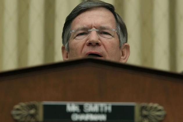
Lamar Smith is Hot and Bothered about Climate Science. US News explains the probe of NOAA data and studies on the alleged “pause” and how it’s become just the latest political football in Washington D.C. Here’s an excerpt: “…Some see a bit of a parallel between the Soviet-style intimidation and a recent campaign in the House Science, Space and Technology Committee, where Chairman Lamar Smith has pressed forward with a probe questioning the processes and findings of a federal scientific agency – one that has led critics to accuse the Texas Republican of abusing his power and to warn of a chilling effect on further scientific research. Smith has demanded via subpoena, public pronouncements and heated letters that the National Oceanic and Atmospheric Administration turn over internal emails on global warming research. The Texas Republican also has sought to bring agency staffers and NOAA Administrator Kathryn Sullivan into closed-door, deposition-like interviews...”
Photo credit above: “House Science Committee Chairman Lamar Smith, R-Texas, has put federal climate scientists in his crosshairs.”
The Growing Republican Rift over Climate Change. As a moderate Republican (remember those?) science-denial makes me crazy and prone to moments of despair, but I sense the ship is turning on climate science, however slowly. Here’s the intro to a story at desmogblog: “As the world gears up for the climate negotiations kicking off in Paris next week, Republicans in the United States are doing everything in their power to make sure that no climate deal takes place without their approval (which will never happen.) But there are a few Republicans in leadership positions in Washington that have had enough of being labeled the “anti-science” party, and they are hoping to turn the GOP onto the idea that climate change is very real. Republican Senators Kelly Ayotte, Lamar Alexander, Lindsey Graham, and Mark Kirk have created a new committee that will meet periodically to talk about environment and energy issues...”
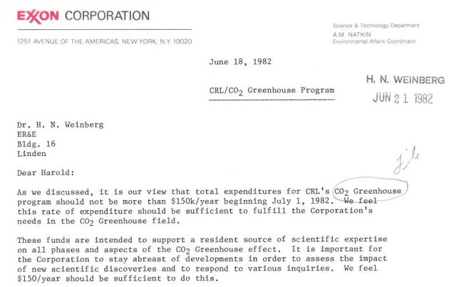
Exxon Made Deep Cuts in Climate Research Budget in the 1980s. Following up their 6-part series, InsideClimate News has the latest installment on Exxon’s climate science research and the mixed messages they were sending at the time; here’s an excerpt: “…But several documents uncovered by ICN show that the budget cuts during the 1980s were steep and sudden. The cuts reversed the course that the company followed in the late 1970s, when top company scientists warned Exxon’s management for the first time of the risks of climate change, and launched internal research programs unparalleled among its oil industry peers. ICN provided an Exxon spokesman copies of the documents being published today and requested any additional information about climate research spending during the 1980s, the period closely examined in ICN’s series, “Exxon: The Road Not Taken.” The spokesman, Alan Jeffers, declined to provide any additional budget numbers...”
Anthropogenic Global Warming (AGW) Subjected to Rational Analysis. Here’s an excerpt of a story at frackcheckwv.net: “…Consensus science is a phrase often heard today in conjunction with anthropogenic global warming (AGW). Is there a consensus on AGW? There is. The tens of thousands of scientists who belong to the American Association for the Advancement of Science, the American Chemical Society, the American Geophysical Union, the American Medical Association, the American Meteorological Society, the American Physical Society, the Geological Society of America, the U.S. National Academy of Sciences and, most notably, the Intergovernmental Panel on Climate Change all concur that AGW is in fact real. Why?…”
Climate Change is an Investment Risk, Says BlackRock. Even without a price on carbon there’s already a signal in the marketplace and many companies and investors are already hedging their bets, banking on a low-carbon future. Here’s an excerpt from CBC News: “Climate change risk has arrived as an investment issue, according to the world’s largest institutional investment manager. BlackRock Inc., with $4.5 trillion US under management, has begun watching carbon risk on all its portfolios. In a new report, it warns a raft of new rules to curb carbon emissions out of the climate change summit in Paris may have a significant effect on investment returns in the years ahead...”

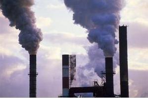
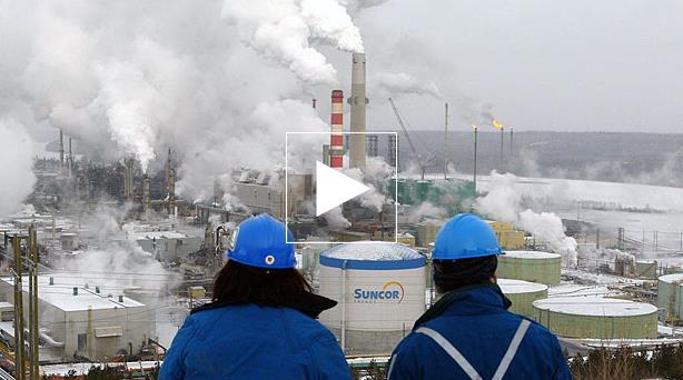
Energy Companies Risk $2.2 Trillion as Climate Goals Cut Demand. Here’s more perspective on carbon-related risk from Bloomberg Business: “Oil, natural gas and coal producers are risking $2.2 trillion by investing in projects for which there will be no demand if the world meets a United Nations target of limiting the rise in temperature to less than 2 degrees Celsius, a non-profit think tank said. No new coal mines are needed, oil demand will peak around 2020 and growth in gas will disappoint industry expectations, Carbon Tracker Initiative said Wednesday in a report. The U.S. has the greatest exposure with $412 billion of projects at risk up to 2025, followed by Canada with $220 billion, China $179 billion, Russia $147 billion and Australia $103 billion, according to the think tank...”
