The Weather Blog
Daily weather updates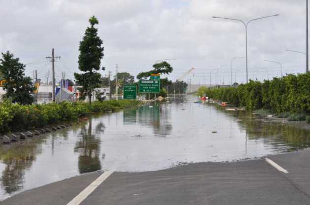
Traffic Nightmare? 1 Month’s Worth of Rain Possible Today
79 F. high temperature in the Twin Cities Wednesday.
77 F. average high on June 10.
77 F. high on June 10, 2014.
June 10, 1926: Downpour at Mahoning. 3.05 inches fell in 45 minutes.

Flash Flood Risk
Being surprised by flooding in June is a little like being indignant about snow in January – it comes with the turf. June is the wettest month of the year, on average. And Mother Nature is about to prove it.
Minnesota has warmed 3 degrees F. since 1800. That’s not a climate model, that’s based on observations, factoring in the urban heat island effect.
Basic physics: warmer air can hold more water vapor. There’s more fuel floating overhead. When it does rain it tends to rain harder. 4 of the last 5 Junes have been “historically wet”, according to Dr. Mark Seeley. Maybe it’s a coincidence.
Rain becomes steadier and heavier as the day goes on today; the best chance of downpours during the PM hours. Models print out some 2-4 inch amounts. More parking lots, asphalt & concrete means a higher risk of flash flooding for urban areas.
The drive home later today may be a vehicular freak show; a white-knuckle ordeal of mud & construction cones. Good luck out there.
Skies clear Friday; sun much of Saturday giving way to more thunder Saturday night and Sunday.
From drought to flood, on a smaller scale than Texas, we pray. Are we in for some weather-whiplash?
It’s looking that way.
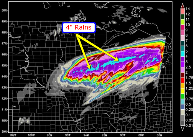
Seriously Wet. The latest WRF model (courtesy of HopWRF) shows an impressive shield of rain from today’s storm, a cyclonic swirl that resembles something you might expect to see in March or October – a little odd of June. But odd is the new normal right? Where the axis of 4″+ rains will set up is still in question, but there’s now little doubt that many locations over the southern third of Minnesota will get soaked by 2-4″ of rain today and tonight.
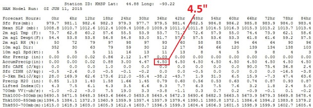
Consistent Model Guidance. I was skeptical when the 12z NAM model printed out 3.5″ of rain. And then came last night’s 00z run, with 4.5″ of rain by breakfasttime Friday. The heaviest rains come this evening and early tonight, when the risk of urban flooding, flash flooding will peak. Travel conditions will become increasingly difficult as the day goes on today; leave PLENTY of extra time to get home this afternoon and evening.
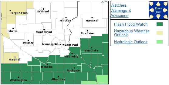
Flash Flood Watch. I wouldn’t be surprised to see the local office of the Twin Cities National Weather Service extend the flood watch farther north, to include the immediate metro area. Details on the watch:
MODERATE TO HEAVY RAIN WILL MOVE INTO SOUTHERN MINNESOTA THURSDAY
MORNING AND SPREAD INTO WESTERN WISCONSIN BY THURSDAY AFTERNOON.
RAIN WILL BE HEAVY AT TIMES...WITH RAINFALL RATES UP TO TWO INCHES
PER HOUR POSSIBLE...ESPECIALLY THURSDAY AFTERNOON INTO THE
EVENING. 2 TO 4 INCHES OF RAIN ARE CURRENTLY EXPECTED ALONG AND
SOUTH OF A LINE FROM NEW ULM...TO HASTINGS...TO CHIPPEWA FALLS
WISCONSIN. WITHIN THIS AREA...STORM TOTAL RAINFALL AMOUNTS IN
EXCESS OF 4 INCHES WILL BE POSSIBLE...WITH THE MOST LIKELY REGION
FOR THAT RIGHT NOW BEING ALONG AND NEAR A LINE FROM FAIRMONT...TO
OWATONNA...TO AUGUSTA WISCONSIN. RUNOFF FROM THIS RAIN WILL HAVE
THE POTENTIAL TO LEAD TO RAPID RISES IN LOCAL CREEKS AND
STREAMS...ALONG WITH PONDING OF WATER IN LOW LYING AREAS.

Gully-Gushing. Most June rains come in the form of thunderstorms, one at a time or “training” storms, where cells repeatedly reform over the same boundary, passing over the same counties, like the cars in a train. That’s where some of our extreme amounts usually come from this time of year. There may be a few thunder claps out there by evening but most of today’s rain will be stratiform, caused by rapid and sustained uplift of warm, moist air, passing up and over a shallow layer of cooler air in the ground – it probably won’t get out of the 60s here today, setting the stage for close to a month’s worth of rain in 24 hours. NAM animation: NOAA.
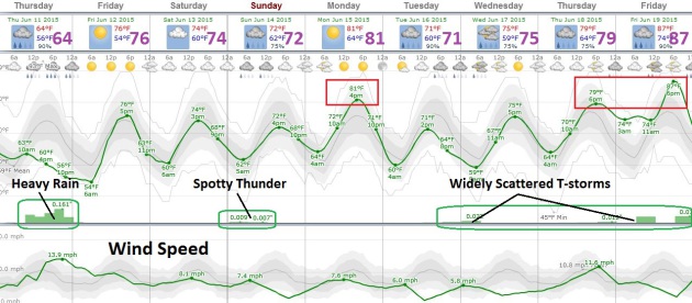
A Tropical Pattern. No excessive heat in sight; a series of weak Canadian cool frontal passages keep the blast-furnace heat well south of Minnesota. Those puffs of cooler, drier air will set up east-west boundaries that will attract more scattered T-storms Saturday night into Sunday, another chance the latter half of next week. Source: Weatherspark.

Alaska Just Had Its Hottest May in 91 Years. Here are more details from The Washington Post: “…And now, the National Oceanic and Atmospheric Administration reports that the state as a whole experienced its warmest May in the weather books. As the agency puts it:
The Alaska statewide average temperature for May was the warmest on record in 91 years of record keeping at 44.9°F, 7.1°F above average. The warmth in Alaska was widespread with several cities were record warm, including Barrow and Juneau.
Photo credit above: “View of a sunset from an Alaska Marine Highway ferry ride near Sitka, Alaska, on June 16, 2014.” (Linda Davidson/The Washington Post).
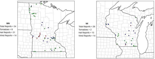
Severe Weather Reports So Far in 2015. Here are the locations of tornadoes and funnels (red), 1″+ hail (green dots) and straight-line wind damage (blue) for Minnesota and Wisconsin so far this year. All things considered it’s been pretty quiet – no devastating squall lines or major tornadoes impacting heavily populated areas. So far we’ve been pretty lucky. Source: NOAA SPC.

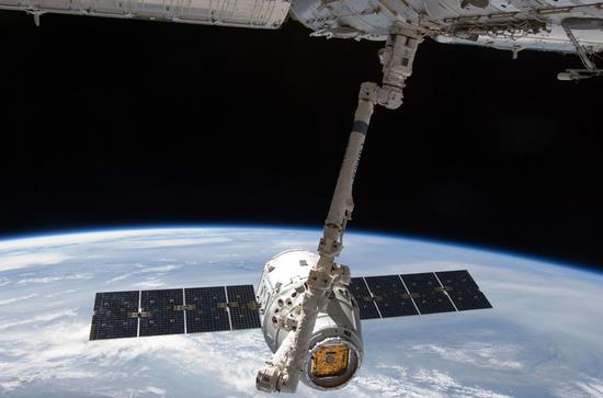
SpaceX Founder Files With Government To Provide Internet Service From Space. Is there anything Elon Musk (aka Tony Stark) can’t do? Here’s a snippet from The Washington Post: “Elon Musk’s space company has asked the federal government for permission to begin testing on an ambitious project to beam Internet service from space, a significant step forward for an initiative that could create another major competitor to Comcast, AT&T and other telecom companies. The plan calls for launching a constellation of 4,000 small and cheap satellites that would beam high-speed Internet signals to all parts of the globe, including its most remote regions. Musk has said the effort “would be like rebuilding the Internet in space…”
Photo credit above: “The SpaceX Dragon commercial cargo craft is grappled by the Canadarm2 robotic arm at the International Space Station in this May 25, 2012, NASA handout photo.” (NASA/Reuters).
TODAY: Rain gets steadier and heavier. Flash flood risk by evening. Winds: East 15+ High: 68
THURSDAY NIGHT: Rain, a few embedded T-storms. Flood risk continues. Low: 56
FRIDAY: Damp start, becoming sunny. High: 76
SATURDAY: Lukewarm sun much of the day, thunder late at night. Wake-up: 57. High: 76
SUNDAY: Sticky sun, spotty T-shower. Dew point: 63. Wake-up: 62. High: 74
MONDAY: More sunshine, less humid. Wake-up: 64. High: 81
TUESDAY: Clouds increase, PM T-showers. Wake-up: 62. High: 76
WEDNESDAY: Thundery start, partial clearing. Wake-up: 63. High: 80
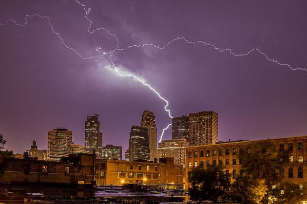
* file photo credit above: Bob Israel, RJI Photography.
Climate Stories…

Climate Encyclical Expected To Send Strong Moral Message To The World. Here’s a video and story excerpt of what we might expect from Pope Francis from The Catholic Sun: “Pope Francis’ upcoming encyclical on ecology and climate is expected to send a strong moral message — one message that could make some readers uncomfortable, some observers say. “The encyclical will address the issue of inequality in the distribution of resources and topics such as the wasting of food and the irresponsible exploitation of nature and the consequences for people’s life and health,” Archbishop Pedro Barreto Jimeno of Huancayo, Peru, told Catholic News Service…”

You Are About To See An Incredibly Rare Cloud, And It’s Proof The Climate Is Changing. Bloomberg Business has more details; here’s a clip: “…That’s when noctilucent clouds, the world’s highest, peak in number and show up in the night sky just after sunset as electric-blue swirls in the mesosphere, the coldest place on the planet. Usually visible only in the polar regions, the clouds now sometimes appear as far south as 40 degrees latitude in the Northern Hemisphere, according to Cora Randall, a professor at the University of Colorado’s Laboratory for Atmospheric and Space Physics in Boulder. That’s because the mesosphere, which nears the edge of space, is changing, possibly “due to a change in climate,” he said. “We believe that these clouds are a really sensitive indicator...”
File photo of noctilucent clouds above courtesy of NASA.

Even Skeptics Can Profit From Climate Change. Bloomberg’s Barry Ritholtz is a professional money manager. Here is a section of a recent column at Bloomberg View that made me do a double-take: “…In the real world, climate-change deniers are and will be giant money losers. I expect those who suffer from cognitive dissonance over whether global warming is real will soon be greeted by a brutal Darwinian result in the markets. I don’t make many forecasts but here is one: It is only a matter of time before the deniers exist only in think tanks funded by the fossil energy industry and oddball conspiracy groups...”

Don’t Care About Climate Change? What About The Health Of Children? Recent studies in Australia should give any parent reason for concern; here’s an excerpt at The Guardian: “…Doctors are concerned Australian children are already suffering health effects from increasing temperatures, and more frequent and severe droughts, floods, bushfires and heatwaves as a result of climate change. Doctors are also worried about rising temperatures causing the spread of mosquito-borne diseases, such as dengue, to areas further south, affecting air pollution levels, and increasing allergenic pollen in the air leading to higher rates of hayfever and asthma. Recent research from Brisbane and Westmead Children’s Hospital in Sydney demonstrated that higher temperatures increased rates of child emergency department attendances for fever, gastroenteritis and asthma...”
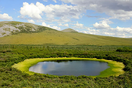
Climate Peril Stirring in Permafrost, Experts Tell U.N. Business Standard has the story – here’s an excerpt: “…About 1,500 billion tonnes of heat-trapping carbon gas are estimated to be locked in permafrost, which is thawing as the climate warms, according to new research. Releasing the carbon will create a vicious cycle in Earth’s global-warming problem, said Susan Natali of the Woods Hole Research Center in Massachusetts. The estimated amount of carbon in permafrost — perennially frozen ground covering about a quarter of exposed land in the northern hemisphere — represents about twice the volume currently in the atmosphere, she said...” (File photo: NASA).
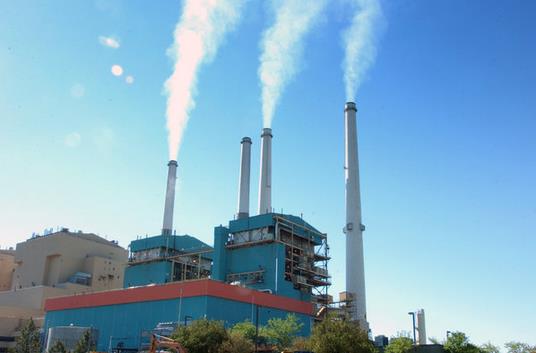
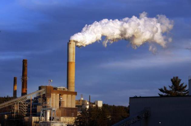
Emissions From Energy Have Slowest Gain Since 2009 Drop, BP Says. Bloomberg Business has the article; here’s a snippet: “Carbon dioxide emissions from energy use had the slowest growth last year since a drop in 2009 as Chinese consumption of coal flattened, according to BP Plc. Output of the greenhouse gas from burning fossil fuels rose 0.5 percent from the previous year, London-based BP said Wednesday in its annual Statistical Review of World Energy. That was the smallest increase for any year since 1998, with the exception of 2009, when emissions fell 1.5 percent, it said…” (File photo: Matt Brown, AP).
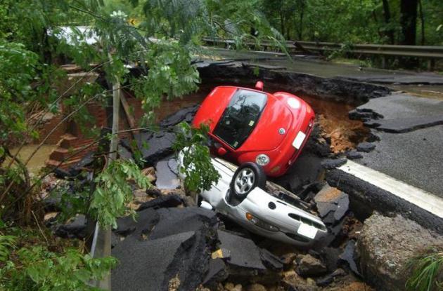
Risk of Flooding Rises With Global Warming, Says Study. We’re witnessing more frequent bursts of extremely heavy rain. In many cases Infrastructure designed and built in the 20th century can’t keep up with 21st century downpours. Here’s an excerpt of a story at The Toronto Star: “…Peak rainfall during storms will intensify as the climate changes and temperatures rise, leading to increased flash flood risks, especially in urban areas, new research from Australia indicates. Scientists at the University of New South Wales in Sydney analyzed about 40,000 storms from three decades in Australia and found that warming temperatures are dramatically disrupting rainfall patterns within storms…”
Image credit above: Virginia Department of Transportation.
Republican Pledges $175 Million To Push Party on Climate. An unlikely headline, signs of a growing schism within the GOP on environmental matters. Here’s an excerpt from Politico: “A Republican entrepreneur is putting a whopping $175 million behind a campaign whose message will have some party stalwarts seeing red: The GOP needs to deal with climate change. North Carolina businessman Jay Faison will launch a social media and online advertising blitz, backed by state and national digital advocacy efforts and a series of strategic grants, as part of a $165 million campaign run through the ClearPath Foundation...”
Read Paul’s New Book
Caring for Creation: The Evangelical’s Guide to Climate Change and a Healthy Environment