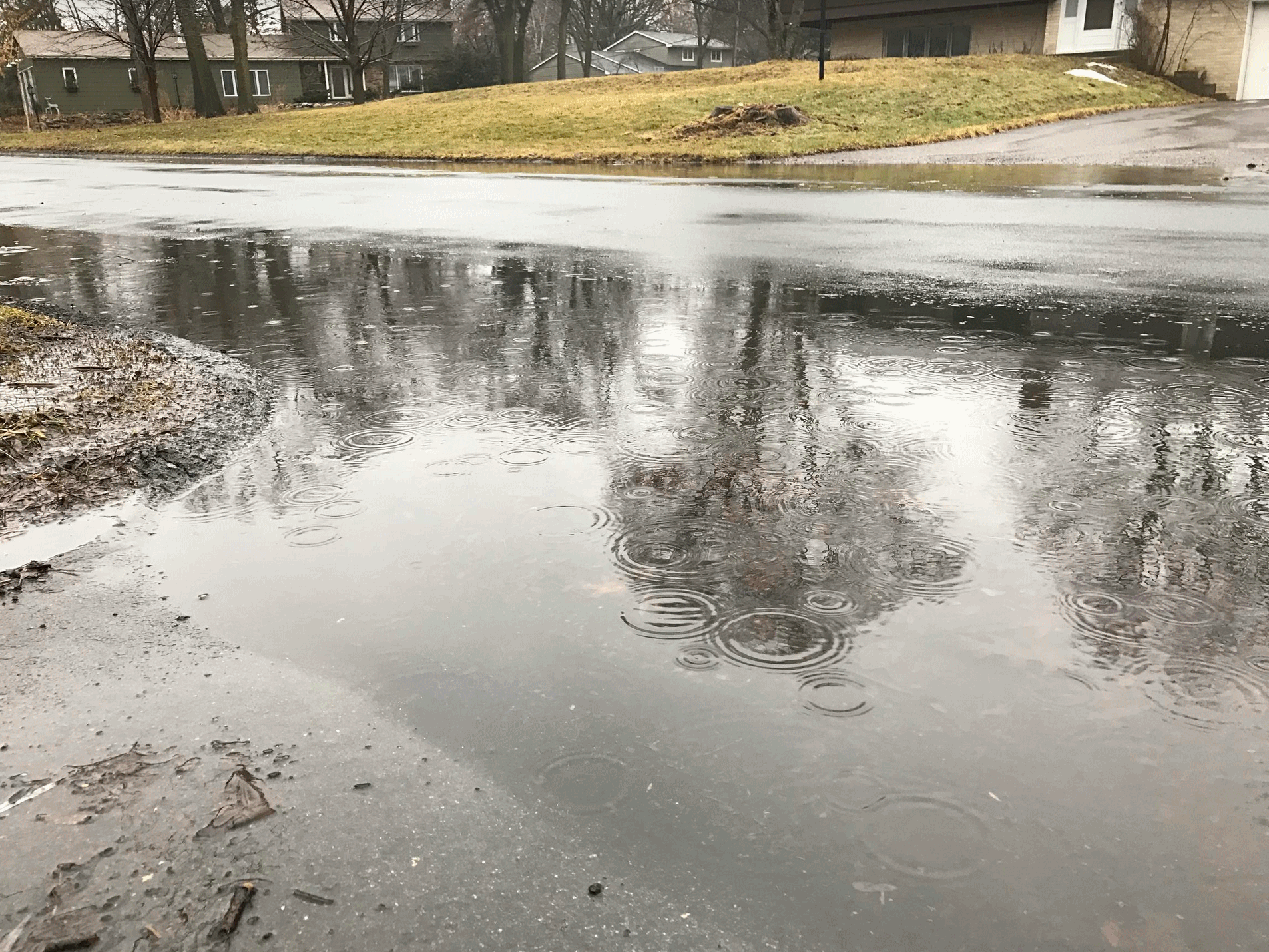
.61″ rain fell at Twin Cities International Airport on Monday.
54 F. high temperature yesterday.
31 F. average high on February 20.
43 F. maximum temperature on February 20, 2016.
February 21, 1965: Strong winds occur, reaching speeds of up to 45 mph in the Twin Cities.
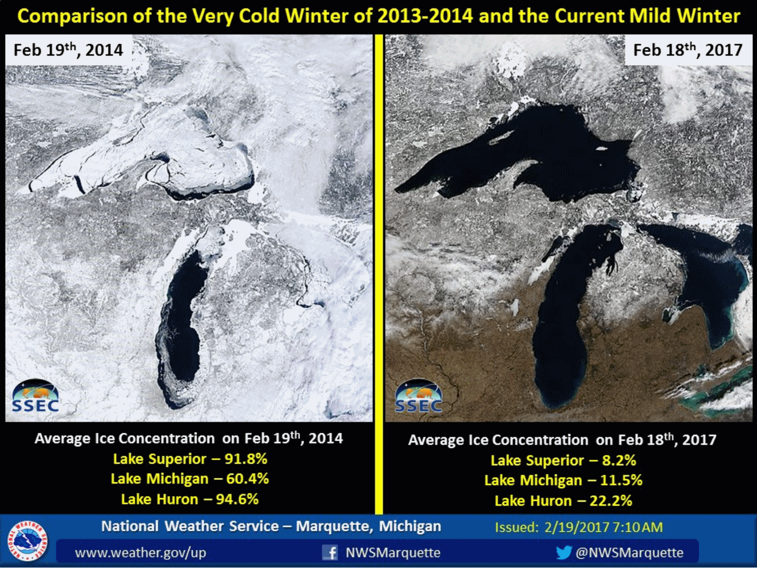
Flooding Rains in February? Welcome to Fake Spring
A rough, back-of-the-napkin calculation suggests we’ve been cheated out of near 2 feet of snow this winter. Two of our biggest storms, yesterday and Christmas Day, fell as a soaking rain. Had it been consistently cold enough for snow most of this (alleged) winter, like it was a generation ago, we’d have 50 inches, instead of 27. And there might still be snow on the ground.
Is that too much to ask for in February?
Hey, I’m enjoying the freakishly premature outbreak of spring like everyone else. It’s a symptom of Minnesota’s warming winters. The 60-degree wow factor comes with a downside: stress and dislocation for Minnesotans who make a living from cold and snow. Have you bumped into any happy snowmobilers or cross country skiers lately? More ticks and mosquitoes surviving through the winter. Stress on fruit trees, and a longer pollen season. 60s in February is a mixed blessing.
Snowy redemption on Friday? Don’t bet on it. A few slushy inches may fall, but the heaviest snow band sets up south/east of the Twin Cities, where plowable amounts are likely.
Old Man Winter is very much on life-support, but don’t retire the coat (or snow shovel) just yet.
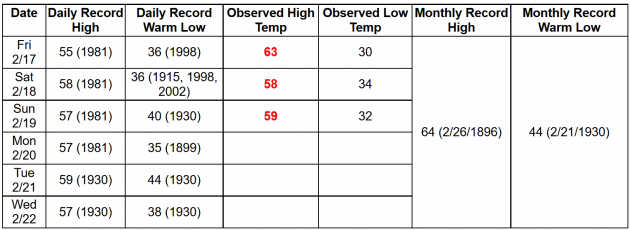
Record Territory Today and Wednesday. Today’s all-time record in the Twin Cities is 59F in 1930. We’ll come very close. The local National Weather Service office has more details.
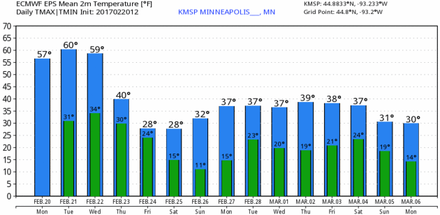
A Temperature Adjustment On The Way. ECMWF guidance suggests highs close to 60F again today and Wednesday (assuming a few hours of midday and afternoon sunshine), then colder Thursday into Saturday as the next storm pulls Canadian air back into Minnesota. Although not as dramatic as our recent taste of April daytime thaws are likely next week. Graphic: WeatherBell.
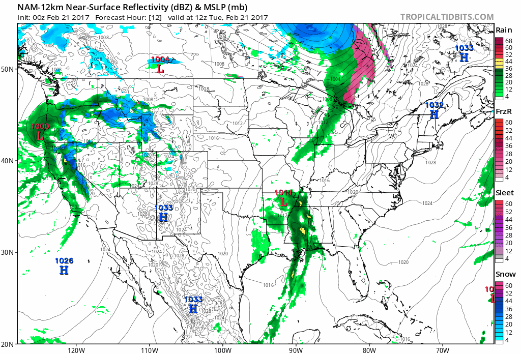
84-Hour Future Radar. Here is NOAA’s 12 KM NAM model, showing moisture slowly diminishing for the west coast by late Wednesday and Thursday, an interesting-looking storm pinwheeling across the Gulf off Mexico into Florida (tropical depression potential?) and a late week storm pushing show, ice and rain into the Midwest. Animation: Tropicaltidbits.com.
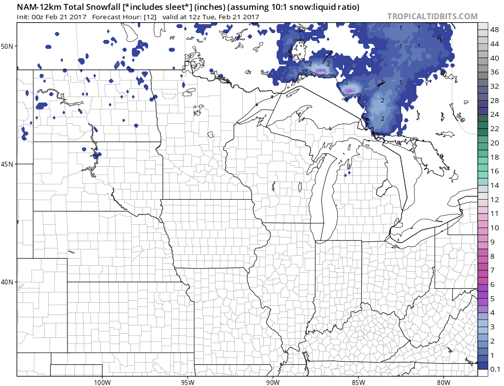
Another Near-Miss? It’s still way too early to fixate on how many inches of slush may pile up later in the week, but the 00z NAM keeps the heaviest snow band south of the Twin Cities; the best chance of a few inches of snow from Denver to Sioux City and Waterloo to Rochester, La Crosse and Tomah.
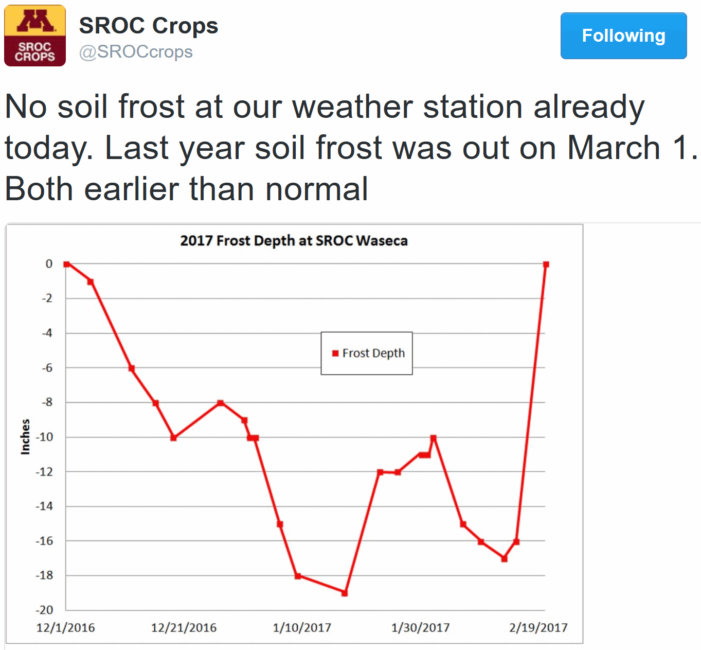
Going – Going – Gone. In the immediate much of the frost is already out of the ground, well ahead of schedule, according to the University of Minnesota.
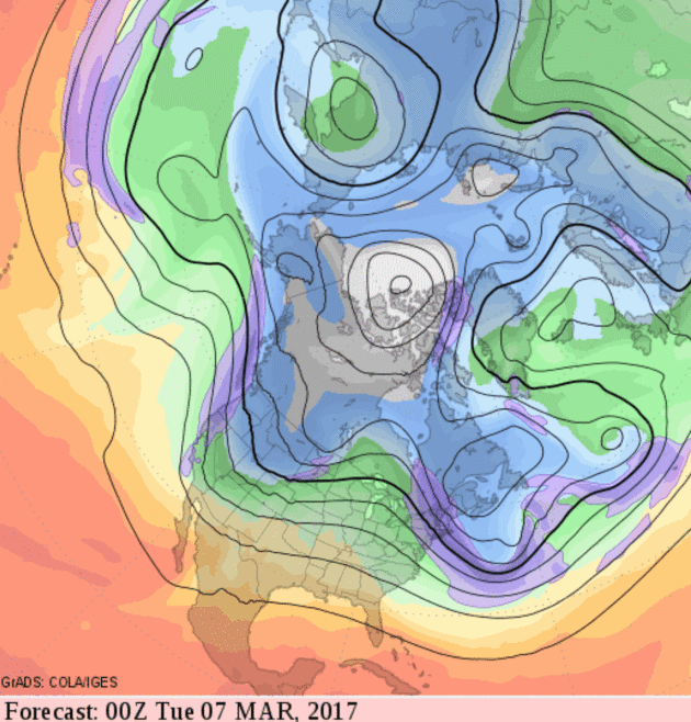
Cold Start to March Northern USA. There will be payback for this stretch of remarkable, April-like warmth across much of the nation. But cold waves in March just don’t pack the punch of January; a higher sun angle and less snow upwind limits how cold it can get. That said, don’t pack away the coats and parkas just yet.
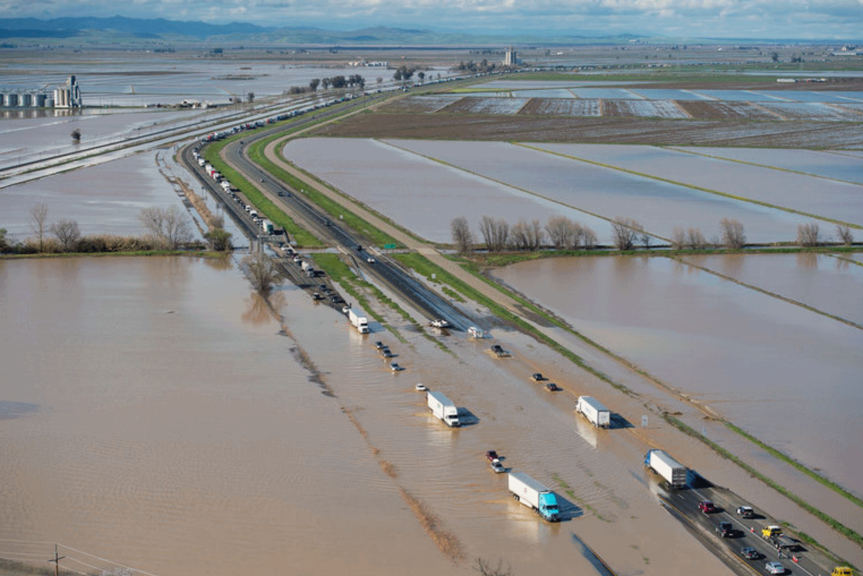
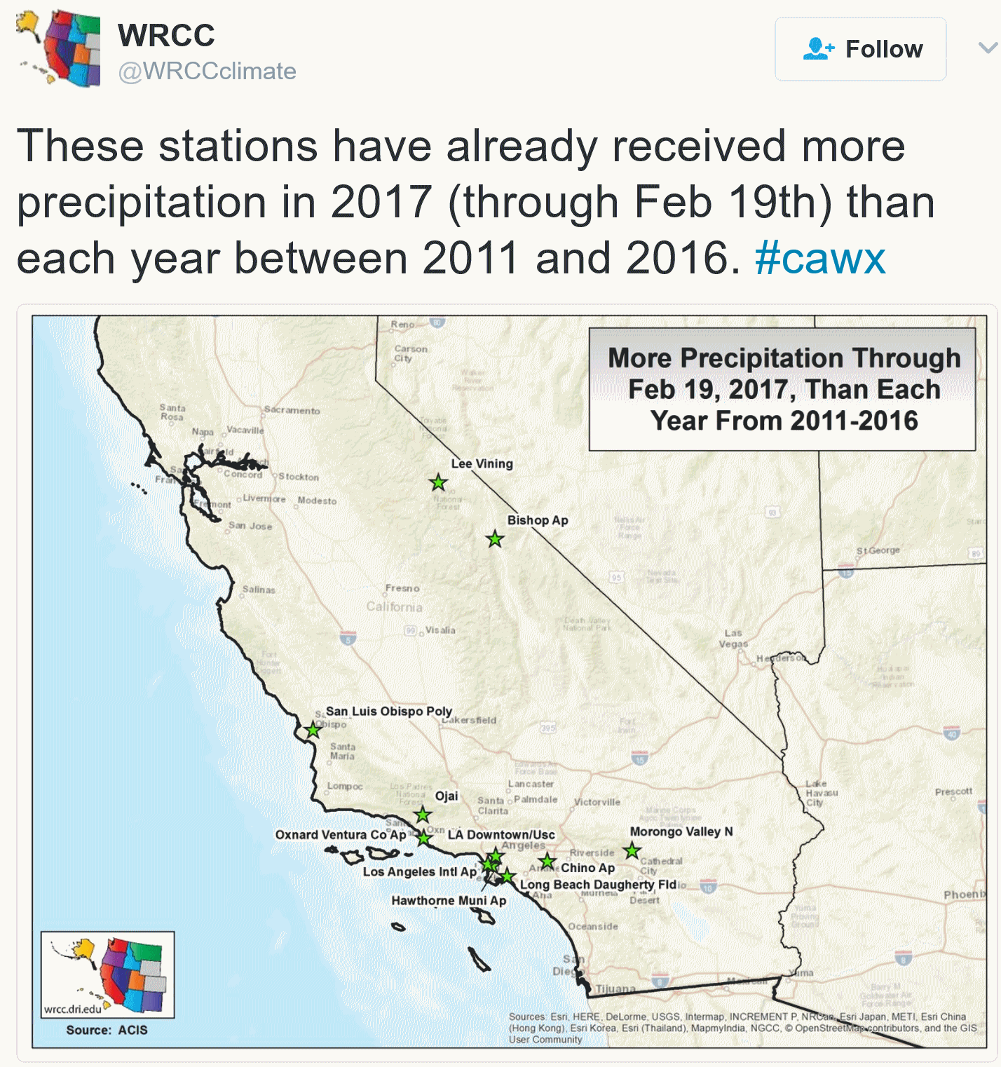
California Braces For More Rain. How Bad Can It Get? Here’s an excerpt from a story at The New York Times: “…This latest storm is what’s called an “atmospheric river” — a weather event more commonly known as the “pineapple express.” It is moist tropical air from the central Pacific trapped in a band between different pressure systems, Mr. Kurth said. When it hits California, it unleashes a high amount of rain. “It’s like a fire hose of moisture when we get these atmospheric rivers,” he said. An atmospheric river is not especially unusual. “We usually get a couple every year,” he said. “On average we get maybe three to five or so. This year we’ve gotten quite a few more.” How many more? “More than a dozen prior to this one,” he said…”
Photo credit: “Flood water crossed over Interstate 5 in Williams, Calif., about 60 miles north of Sacramento on Saturday.” Credit Randy Pench/The Sacramento Bee, via Associated Press.
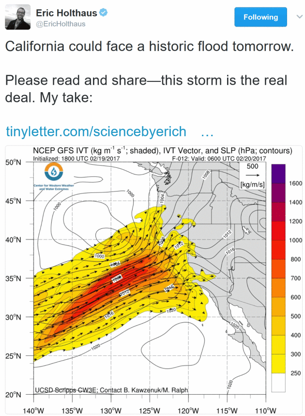
“Flood Emergency” – Historic Flooding for California? Meteorologist Eric Holthaus is (very) concerned about the scenario unfolding across central and northern California. Personally, I see more extensive flooding, but probably not the level of dislocation that Eric is referencing. I hope I’m right. Here’s an excerpt of a recent post: “…Here’s what is causing so much concern: If the atmospheric river stalls, there could be up to a foot of rain in a span of about 36 hours over places that are already flooding—that’s a rainfall intensity that isn’t expected more than once a century, or even more rare. At risk is the vast network of levees and dams and diversions that literally make modern California what it is, and protect hundreds of thousands of people. If this system is compromised, the scale of disaster would be among the worst in U.S. history. A dire 2011 New York Times magazine piece outlines the scenario. It’s not pretty.…”
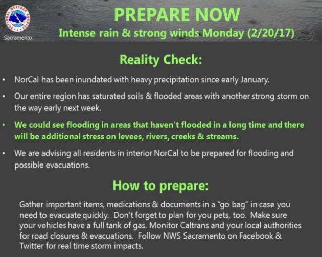
AerisWeather Briefing: Issued Monday, February 20th, 2017
* Another atmospheric river system is impacting parts of California this morning, bringing heavy rain with it to areas like San Francisco and Sacramento.
* Rainfall amounts of 1-5” will be possible across northern California through Tuesday, with most of that falling today. This heavy rain will lead to widespread flash flooding across the region.
* Damaging winds will also be possible, especially as we head toward the evening hours. Wind gusts of 40-60+ mph will be possible.

Morning Radar. Rain is already impacting areas like San Francisco and Sacramento this morning, with totals over three-quarters of an inch since midnight reported in San Francisco, Napa and Santa Rosa.
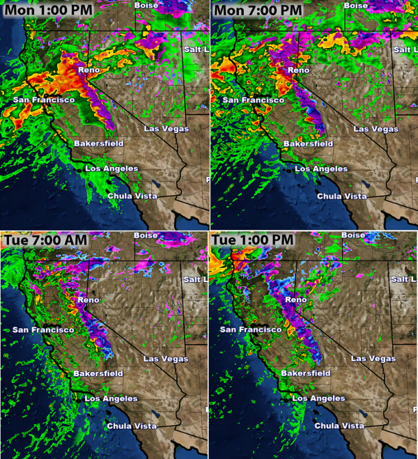
Heavy Rain Continues Today. Rain will continue throughout the day across California, with the heaviest falling across northern portions of the state. Rainfall rates of 0.50”-1.00” per hour will be possible in some of the heaviest rain. Showers will start to taper off during the day Tuesday.
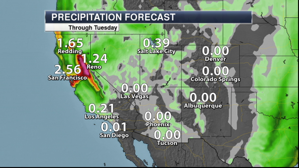
Rain Through Tuesday. This high impact event impacting California will bring the potential of 1-5”+ across northern portions of the state through Tuesday. The heaviest of the rain will fall during today into this evening with rainfall rates of 0.50”-1.00” per hour possible. With wet soils and moderate to heavy rain expected, life-threatening flooding will likely be an issue over the next 24-36 hours. Map: Aeris AMP.
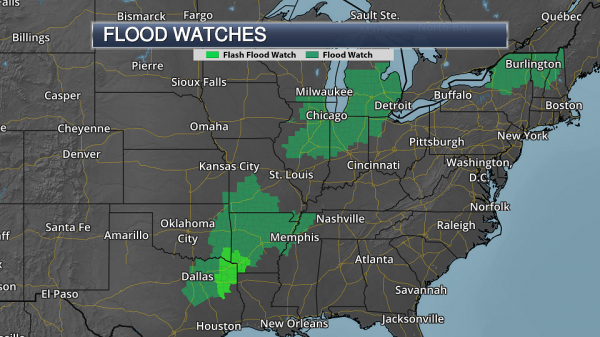
Flash Flood Watches In Effect. Due to the heavy rain, life-threatening flooding will be possible as we head through the next 24-36 hours. Flash Flood Watches have been issued for this threat. The San Francisco office of the National Weather Service said in a statement this morning that, “If you have experienced flooding at any time this winter season, either near your home or on your daily commute, the potential exists for additional flooding in these areas during the next 12 to 18 hours.” In mountainous areas, we will see high snow levels, therefore heavy rain will be falling on top of snowpack, enhancing melting and runoff into rivers and streams.
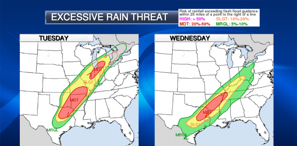
Excessive Rainfall Monday. With the heavy rain expected today across northern California, the Weather Prediction Center has outlined an area around San Francisco and Sacramento under a “moderate” threat of excessive rainfall.
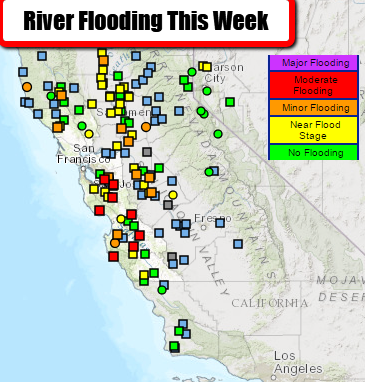
River Flooding Expected. This heavy rain and melting snow will put a strain on local rivers and streams over the next several days, with numerous rivers expected to reach flood stage.
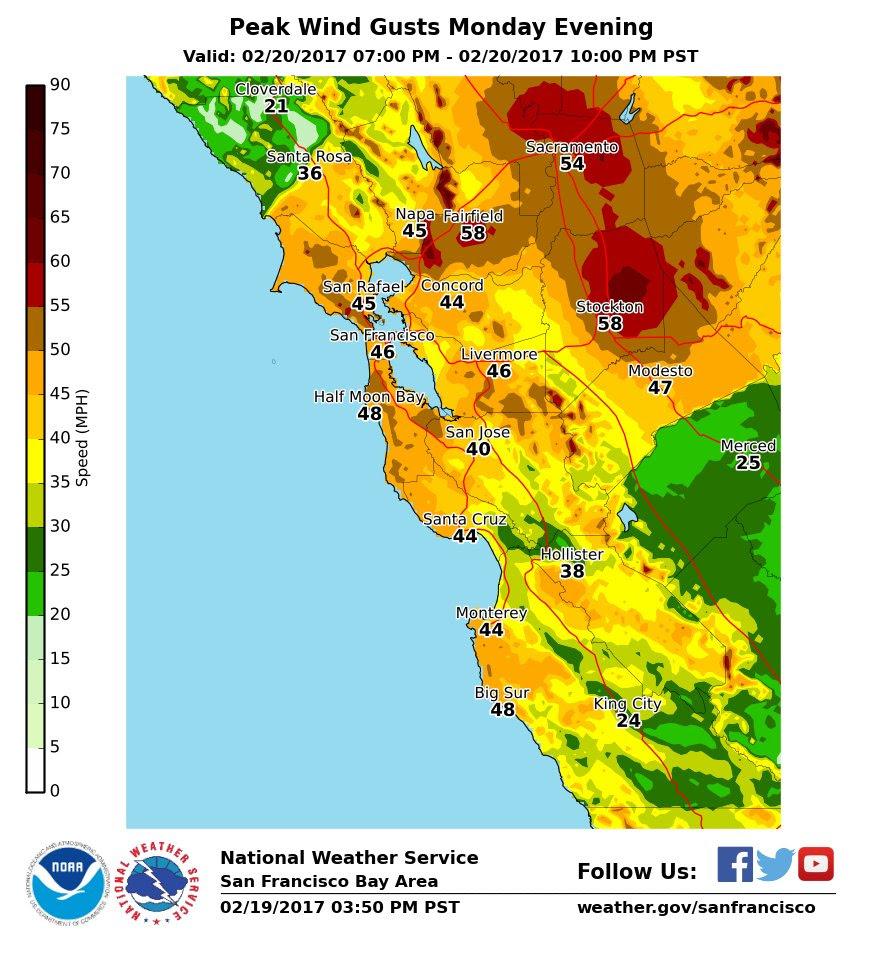
Damaging Winds Expected. Not only are we watching the potential of heavy rain today, but also strong, damaging winds. Wind gusts are expected to be in the 40-60 mph range later this afternoon across the Bay Area and up toward Sacramento.
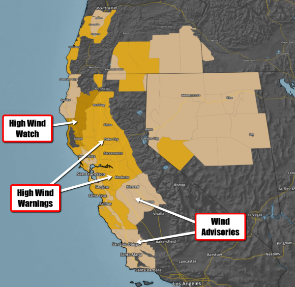
Wind Concerns. High Wind Warnings and Wind Advisories have been issued across California for the potential of at least 40+ mph wind gusts today. These strong winds could lead to numerous downed trees and power outages across the region.
Summary: Heavy rain is once again impacting parts of California into early Tuesday, with potential rainfall amounts of 1-5” in northern California expected. This includes both San Francisco and Sacramento. This heavy rain – potentially falling at 1” per hour throughout the day – will lead to widespread flash flooding across the region, and high rivers over the next several days. Wind gusts will also be on the increase, with gusts of 40-60+ mph likely later today, causing power outages and downed trees. The good news is that drier conditions will start to move in during the second half of the week, with only some periods of light rain expected.
D.J. Kayser, Meteorologist, AerisWeather
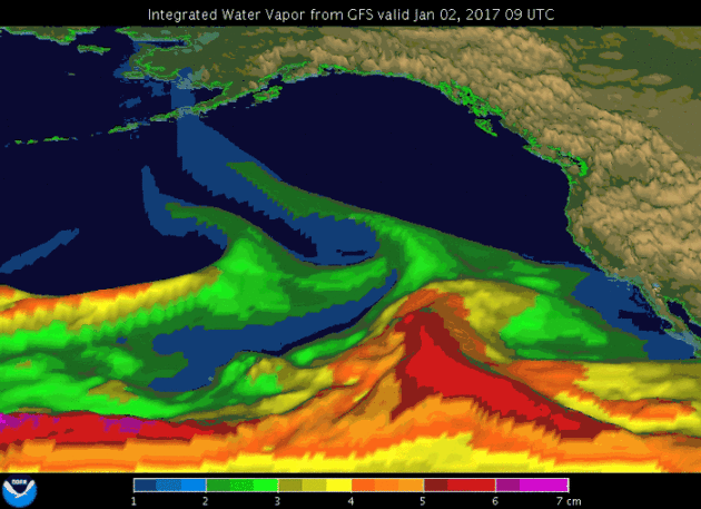
Atmospheric Rivers Bring High Winds Too. Some surprising new research highlighted at NPR: “…Waliser studied two decades of storms around the globe at mid-latitudes — that is, outside the tropics. When he focused on the very windiest — the top 2 percent — he found that “atmospheric rivers are typically associated with 30 and even up to 50 percent of those very extreme cases.” Atmospheric rivers were also responsible for almost that percentage of the very wettest storms, too. But the windiness was surprising. Waliser found that winds during an atmospheric river are typically twice the speed of the average storm. He says emergency responders need to know that. “Not only do [atmospheric rivers] come with this potential for flooding hazards,” he says, “they also come with potential for high impact winds and extremes that can produce hazardous conditions…”
Animation credit: NOAA/ESRL/PSD.
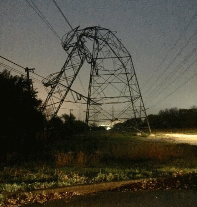
EF-1 Rated Tornado Sweeps Across San Antonio Sunday Night. Here’s an excerpt from Texas Public Radio: “The National Weather Service has confirmed a, EF-1 rated tornado did hit north central San Antonio Sunday night in the area of Highway 281 and the Quarry. At least 150 homes and structures were damaged across San Antonio and Bexar County. The tornado traveled for about 4.5 miles and winds reached speeds of up to 105 miles per hour. National Weather Service meteorologist Bob Fogerty says survey crews were able to determine it was a tornado by the direction of the damage and debris…”
Photo credit: “Power lines are bent and toppled by a storm near Urh Lane and Higgins Road on the Northeast Side late Sunday night bringing with it heavy rain and one confirmed tornado.” CPS Energy
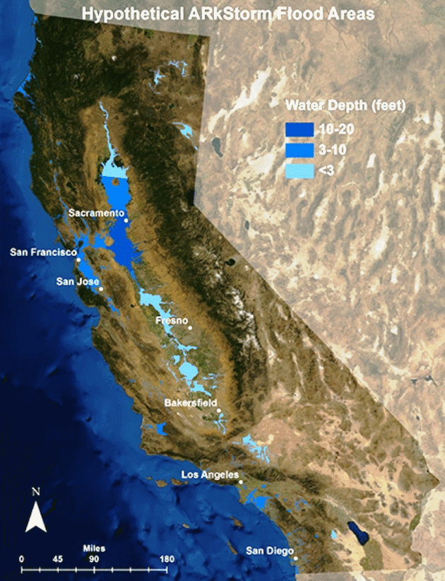
The Central Valley experiences flooding 300 miles long and 20 or more miles wide.Serious flooding also occurs in Orange County, Los Angeles County, San Diego, and the San Francisco Bay Area. Wind speeds reach 125 miles per hour. […] Hundreds of landslides damage roads, highways, and homes. Property damage exceeds $300 billion, most from flooding.[…] Agricultural losses and other costs to repair lifelines, dewater (drain) flooded islands, and repair damage from landslides, brings the total direct property loss to nearly $400 billion. Flooding evacuation could involve 1.5 million residents.
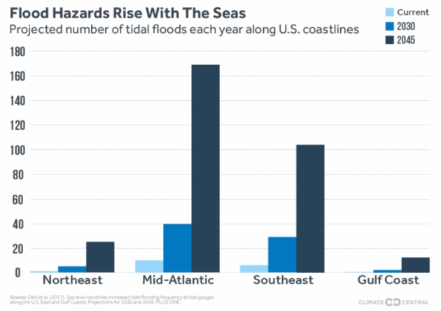
Coastal Cities Could Flood 3 Times a Week by 2045. Here’s an excerpt from Climate Central: “…Washington and Annapolis, Md. could see more than 120 high tide floods every year by 2045, or one flood every three days, according to the study, published last week in the journal PLOS ONE. That’s up from once-a-month flooding in mid-Atlantic regions now, which blocks roads and damages homes. “The flooding would generally cluster around the new and full moons,” said Erika Spanger-Siegfried, a Union of Concerned Scientists analysts who helped produce the new study. “Many tide cycles in a row would bring flooding, this would peter out, and would then be followed by a string of tides without flooding.” The analysis echoed findings from previous studies, though it stood out in part because of its focus on impacts that are expected within a generation — instead of, say, by the end of the century...”

Countries With The Best and Worst Air Quality in the World. Business Tech had an interesting post that caught my eye; here’s an excerpt: “…Neighbouring oil-rich countries, including Kuwait, Qatar, Bahrain and the United Arab Emirates (UAE), dominate the top 10 most toxic countries in the world, and have some of the lowest renewable energy production despite having an ideal climate – low rainfall and prolonged daylight hours – for solar energy. The research also shows that countries in the Middle East have some of the highest number of deaths attributable to air pollution: Turkmenistan witnesses 108 deaths per 100,000 every year. Surprisingly, the Nordic countries are the biggest energy guzzlers, despite their progressive attitude towards sustainability and renewable energy. Iceland has the highest energy consumption in the world, with Norway, Finland and Sweden all ranking in the top 10…”

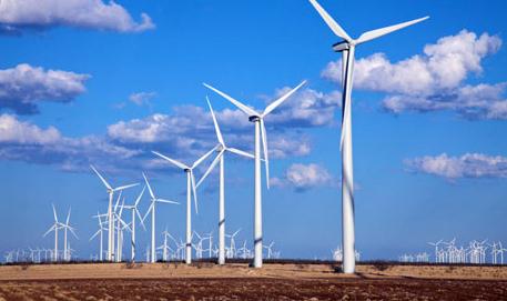
Wind Briefly Sets Record as Source for Electricity in the U.S. A sign of things to come? Climate Central reports: “Wind briefly powered more than 50 percent of electric demand on Feb. 12, the 14-state Southwest Power Pool (SPP) said, for the first time on any North American power grid. SPP coordinates the flow of electricity on the high voltage power lines from Montana and North Dakota to New Mexico, Texas and Louisiana…”

“What to do about mass unemployment? This is going to be a massive social challenge. There will be fewer and fewer jobs that a robot cannot do better [than a human]. These are not things that I wish will happen. These are simply things that I think probably will happen.” — Elon Musk
What is Killing the American Dream: NAFTA or Automation? CNN Money takes a look at Michigan, where there is an ongoing debate about the virtues of robotics and automation.
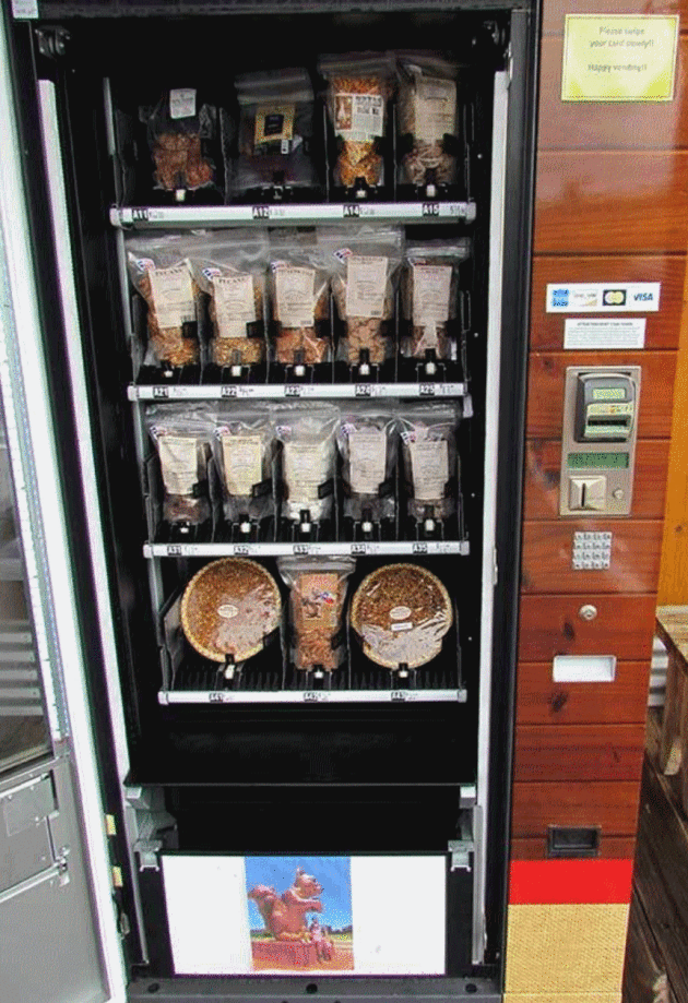
Pecan Pie Vending Machine. What a great country we live in. Here are a couple of excerpts from Atlas Obscura: “If you find yourself driving down Highway 71 though Texas, you’re probably going to want to keep an eye out for signs directing you toward the giant squirrel statue holding a pecan. Because next to this peculiar roadside statue is something that should absolutely not be missed: a vending machine stocked with full-sized homemade pecan pies…The pecan pie machine—thought to be the only one of its kind in the United States (thank you Texas)—is located out front at the Berdoll Pecan Candy & Gift Company shop…”
Photo credit: Berdoll Pecan Farm.

TODAY: Peeks of mild sun. Winds: SW 10-15. High: near 60 (record is 59 in 1930)
TUESDAY NIGHT: Partly cloudy. Low: 43
WEDNESDAY: Last mild day, showers up north. Winds: W 7-12. High: near 60 (record is 57 in 1930)
THURSDAY: Mostly cloudy and cooler. Dry. Winds: N/NE 8-13. Wake-up: 31. High: 41
FRIDAY: Couple inches of snow? More south/east. Winds: N 10-15. Wake-up: 30. High: 34
SATURDAY: Partly sunny and brisk. Winds: NW 5-10. Wake-up: 20. High: 33
SUNDAY: Mix of clouds and sun. No drama. Winds: W 7-12. Wake-up: 19. High: near 40
MONDAY: Milder front arrives. Passing shower. Winds: SE 8-13. Wake-up: 24. High: 43
Climate Stories….

The Problems with Winter Warming. I’m enjoying the extended streak of spring fever in February (!) as much as everyone else, but at the risk of being Debby Downer there are some downsides to spring coming extra-early. Here’s a post from Climate Central: “The decrease in winter cold effectively makes the winter shorter. While that might sound good at first, it comes with consequences for recreation, farming, and the environment. In colder climates, winter-based recreational activities, like skiing, ice fishing, and snowmobiling will become less prevalent. More disease-carrying insects, like mosquitoes and ticks, will survive through a milder winter. Declining snow pack leads to lower reservoir levels, providing less water for irrigation of crops. Fruit trees, which need to become dormant in the winter to blossom in the spring, may produce smaller yields. Pollen counts will rise, which can trigger respiratory illnesses for allergy sufferers.”
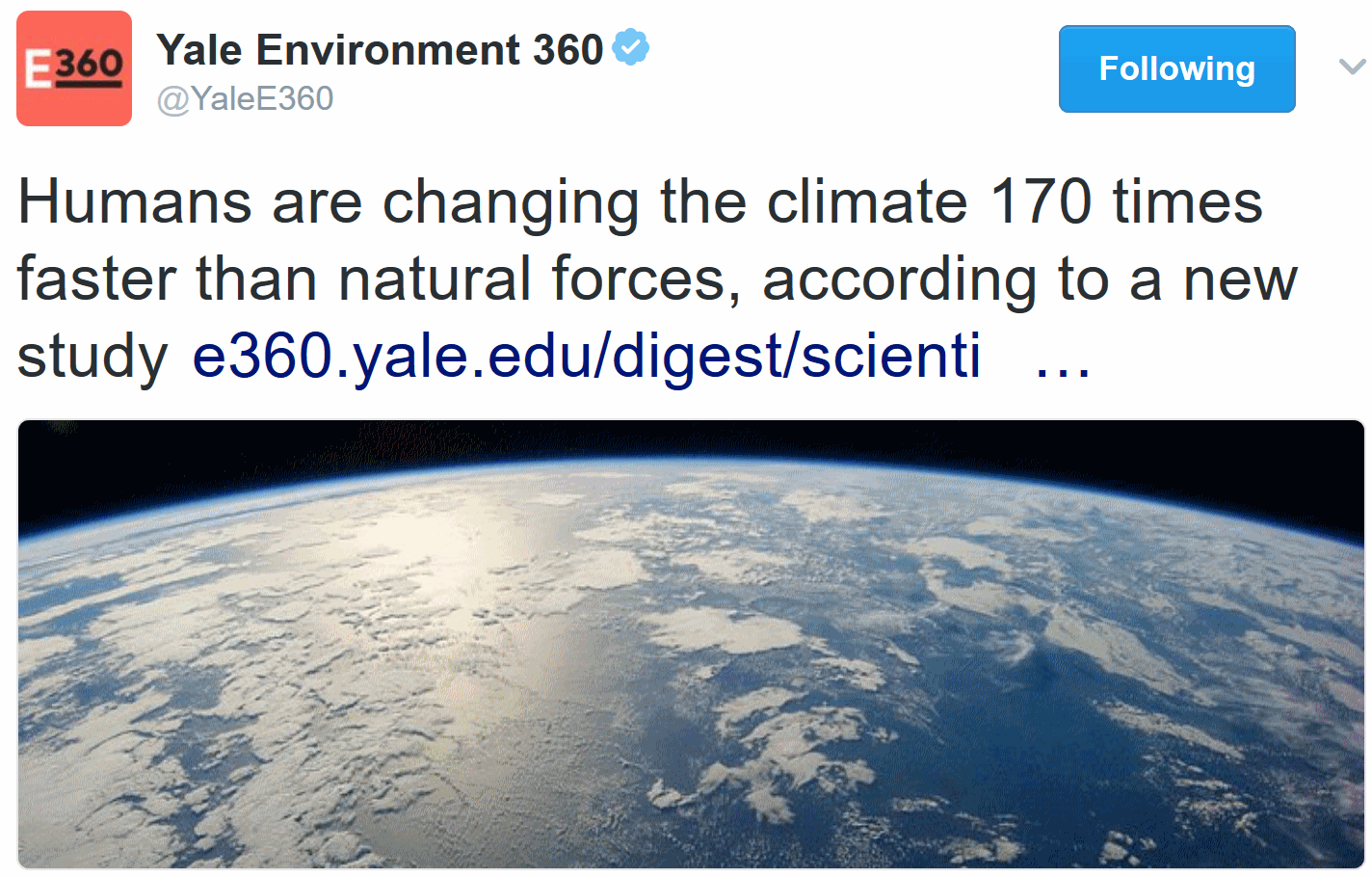
Humans Changing Climate 170 Times Faster than Natural Forces. Yale Environment360 has a summary of new research: “Humans are changing the climate 170 times faster than natural forces, according to a new study published in the peer-reviewed journal The Anthropocene Review. The research is the first mathematical equation to compare the impact of human activity on current climate to naturally occurring changes. For 4 billion-plus years, astronomical and geophysical factors, such as solar heat output and volcanic eruptions, were the dominating influences on Earth’s climate, argue study authors Owen Gaffney and Will Steffan, climate scientists at Stockholm University and Australian National University, respectively. But over the past six decades, human activities like the burning of fossil fuels and deforestation “have driven exceptionally rapid rates of change,” the study says…”

On Climate Change (and Everything Else), We’re on the Side of Facts. So writes National Geographic: “…Covering our climate—where we keep setting records for the hottest year—is one of the most important things we can do. It’s especially crucial in an era when some people claim that there are no “facts” and basic science is loudly questioned without embarrassment. At National Geographic we are proudly nonpartisan. But there are a few matters on which we do take sides:
