April 19, 1928: Chilly air moves across the region with a record low of 19 at the Twin Cities.
April 19, 1893: A heavy snowstorm at Bird Island would last until the 21st. 17 inches of snow would fall, with drifts 3 to 4 feet high.
April 19, 1820: The first tornado ever reported in Minnesota hits the camp that would soon become Ft. Snelling. It damages the roof of a barracks, with no one injured.

The extended outlook? Partly to mostly with a chance. The long-range forecast is a riddle wrapped in an enigma, but new Doppler technology allows us to make a much more accurate short-range, 0 to 3 hour “Nowcast”.
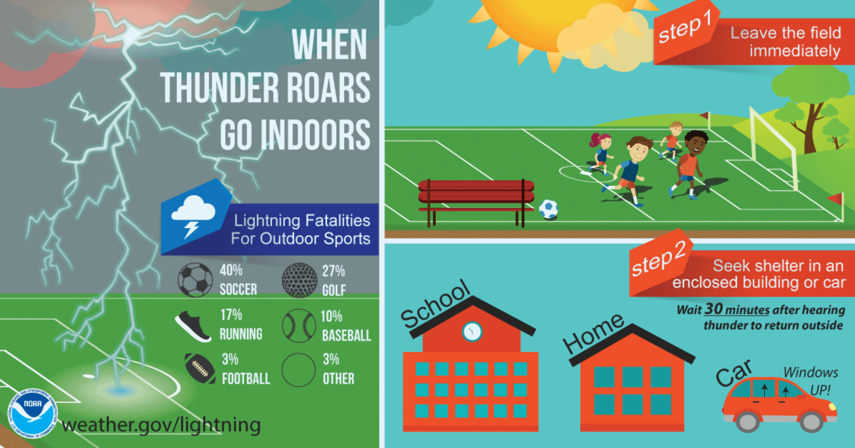
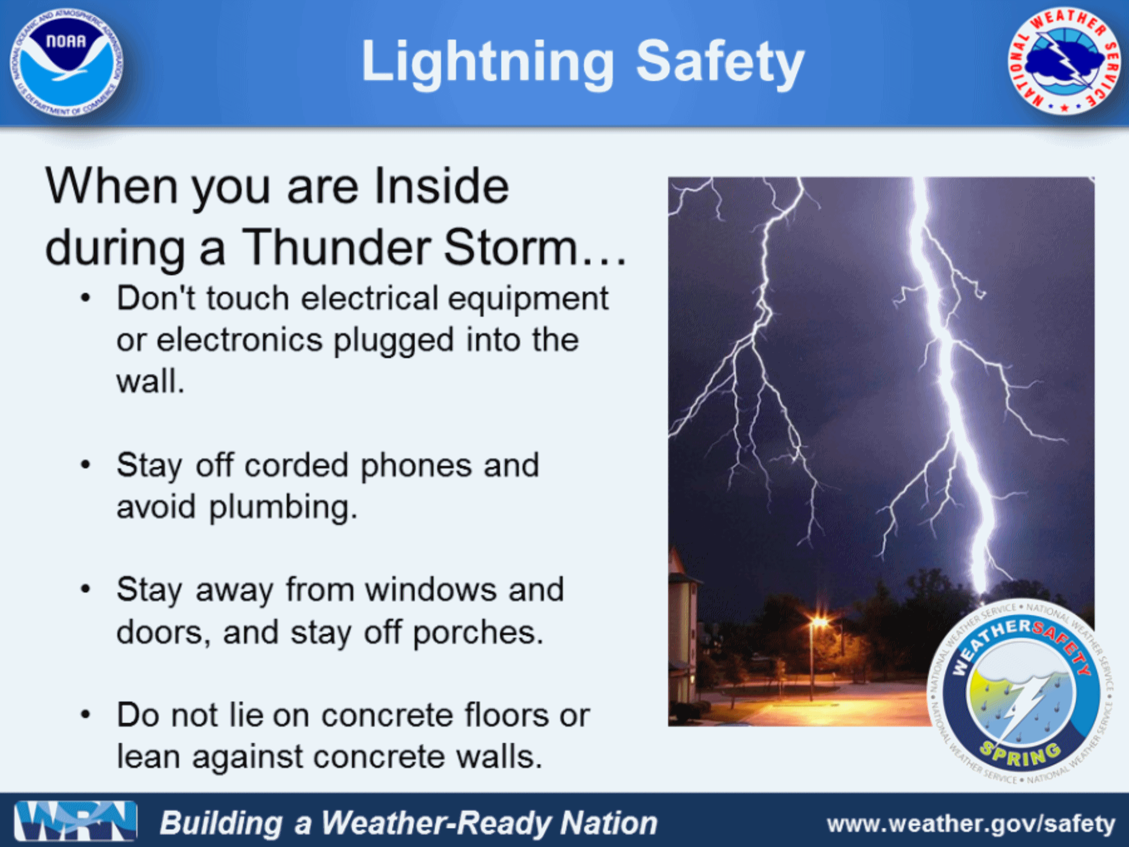
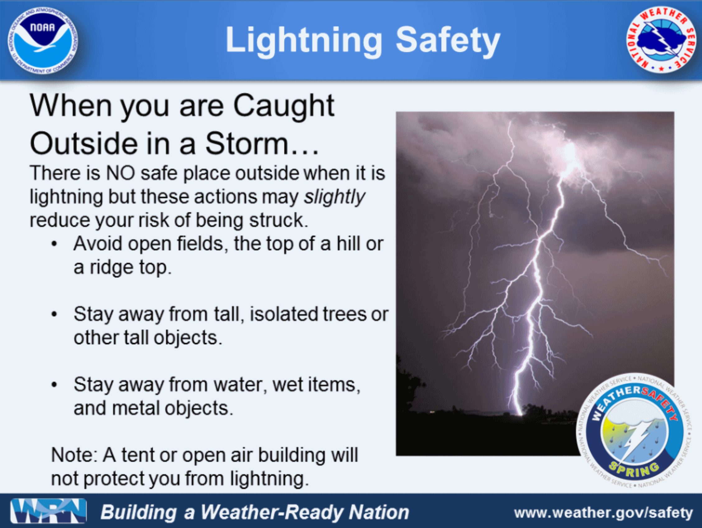
* On average, nearly 50 people die per year in the United States due to lightning (down from an average of nearly 330 people per year in the 1940’s), and nearly four times as many men are killed as women.
* Lightning causes $1 billion in damage each year.
* Lightning is hotter than the surface of the sun, and can reach temperatures around 50,000 degrees Fahrenheit!
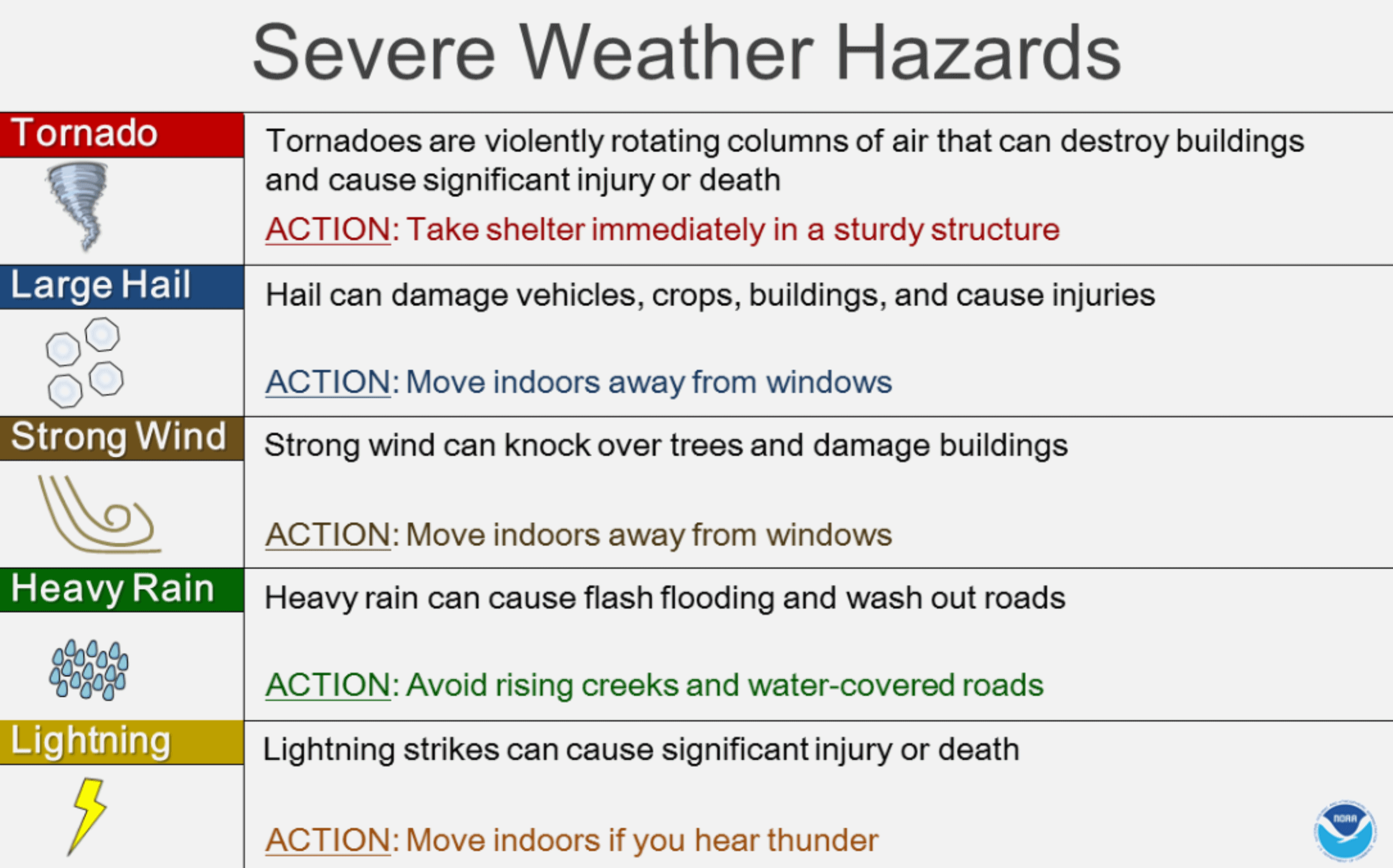
* Hail can exceed softball size (5” diameter) and does even more damage when driven by the wind.
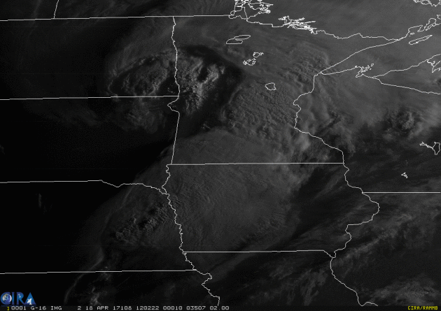
GOES-16 Loop of the Day. Check out a high-resolution visible loop from yesterday’s storm system, courtesy of NOAA and RAMMB. Required disclaimer: “The GOES-16 data posted on this page are preliminary, non-operational data and are undergoing testing. Users bear all responsibility for inspecting the data prior to use and for the manner in which the data are utilized.”
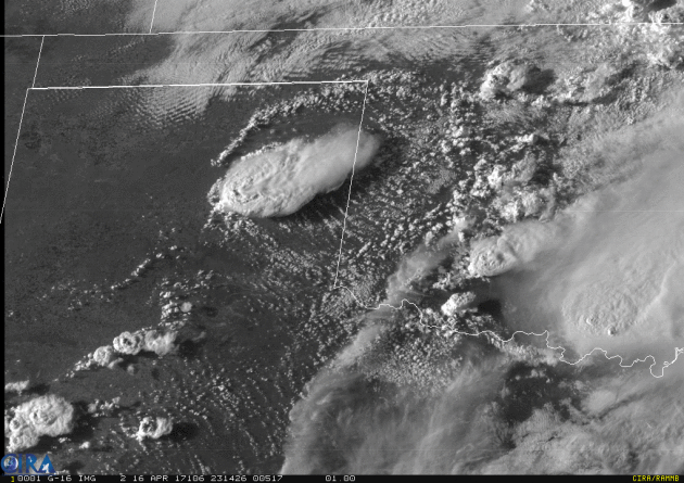
1-Minute Visible Imagery. Forgive me for geeking out, but the resolution is incredible, almost hypnotic. More details via NOAA Satellites: “On Sunday, April 16, 2017, NOAA’s GOES-16 satellite captured this amazing “1-minute” visible imagery of strong storms over Texas and Oklahoma…This imagery was created with the Advanced Baseline Imager’s Band 2, or red-visible band, which capitalizes on the imager’s enhanced resolution to offer meteorologists a closer, more detailed look at the structure of the clouds and the near-storm environment. The reference to “1-minute” in its name refers to the frequency with which GOES-16’s Advanced Baseline Imager captured an image of the storms. This animation appears courtesy of CIRA. To see more animations, visit their website at http://bit.ly/2ePnXoZ….”
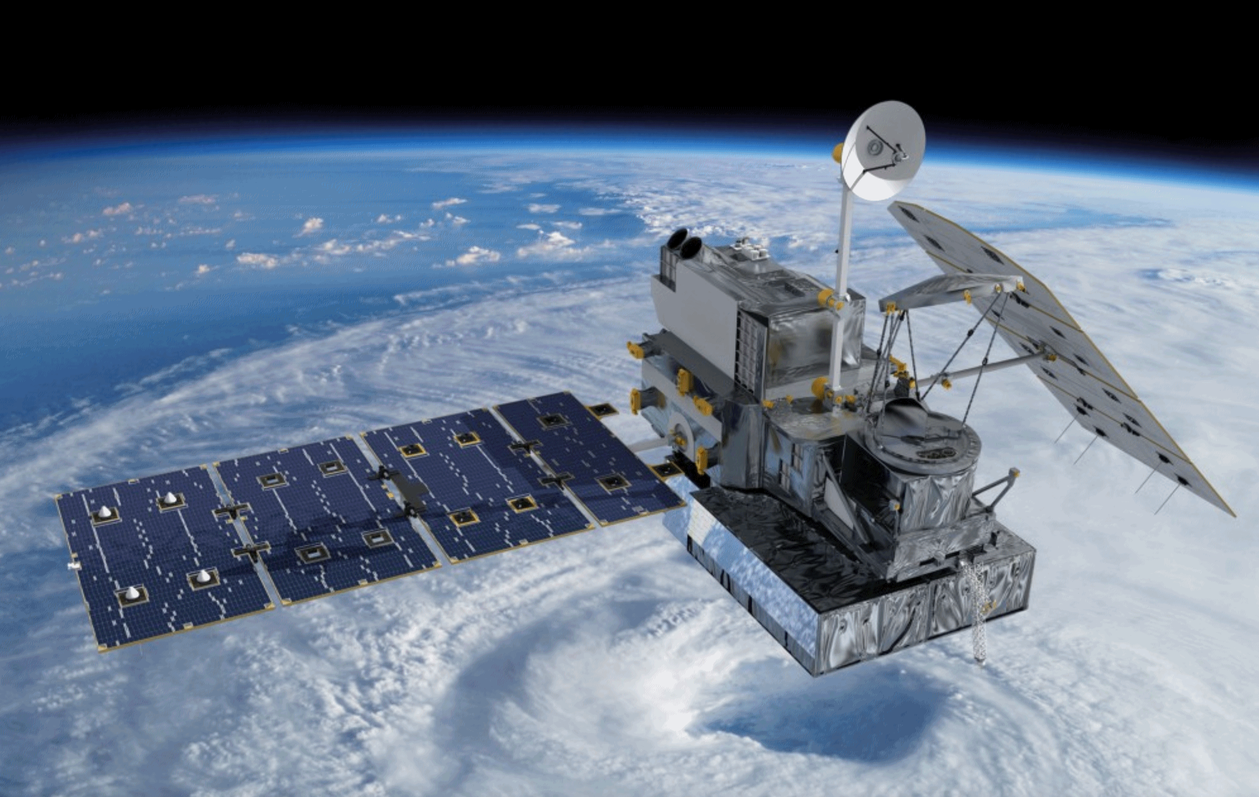
Budget Cuts to Weather and Satellite Programs Are Likely to Cost Us a Lot More Than They Save. Here’s an excerpt from Pacific Standard: “…Organizations from airlines to the military to your local television station use data from these satellites to make operational decisions, issue forecasts, and warn people about tornadoes, hurricanes, and floods. Scientists also use the data to understand how our local weather patterns are affected by long-term changes in climate. There are several different types of weather satellites operated by the federal government, among which is a set that orbits the Earth’s poles. Polar-orbiting satellites help forecasters see global trends driving the weather in the United States, and the data they produce is critical for making forecasts days in advance.Our weather satellites are the responsibility of two federal agencies, the Department of Defense and the National Atmospheric and Oceanic Administration, both of which are behind in their efforts to launch the next generation of polar orbiters. If the existing satellites fail before the new ones are in place, we will have a gap in our weather data, which, the GAO warns, “would endanger lives, property, and our nation’s critical infrastructures...”
File image: NASA Goddard Space Flight Center.
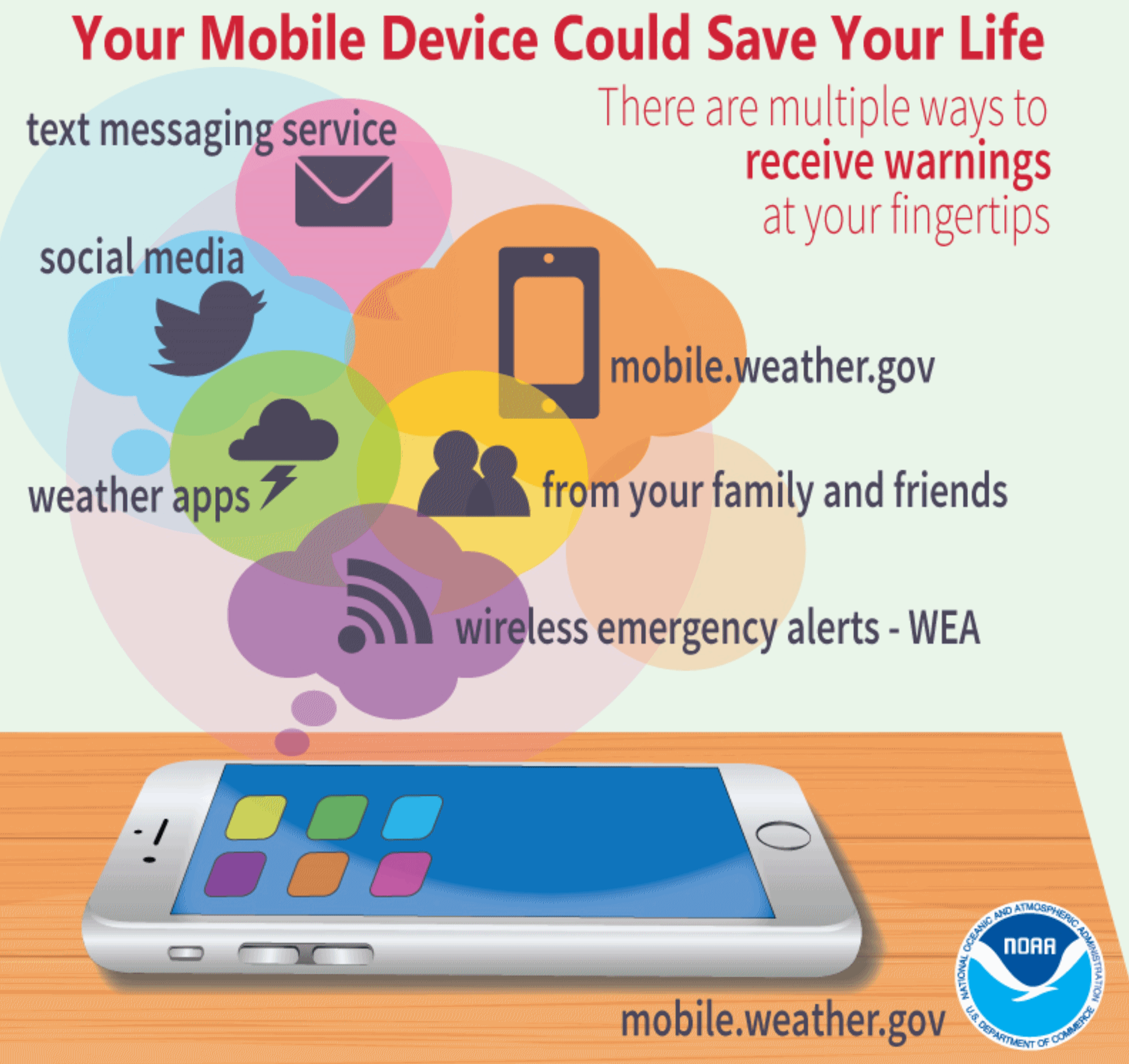
Severe Weather Awareness Week in Minnesota and Wisconsin. The more sources of warning information, the better. But I continue to believe that a NOAA Weather Radio should be mandatory for every home, apartment, office, hospital and nursing home. Nothing else will wake you up at 3 am if a tornado is approaching. Here’s more information from Homeland Security and Emergency Management: “…According to the National Weather Service, Minnesota experiences an average of 40 tornadoes per year. In 2012, 37 twisters touched down. A record was set in 2010 with 104 tornadoes across the state. Understanding this threat and knowing what to do when a tornado is approaching can save lives. Take advantage of Severe Weather Awareness Week to review your own and your family’s emergency procedures and prepare for weather-related hazards...”
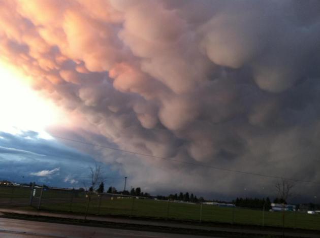
File photo: Randy Widmayer.
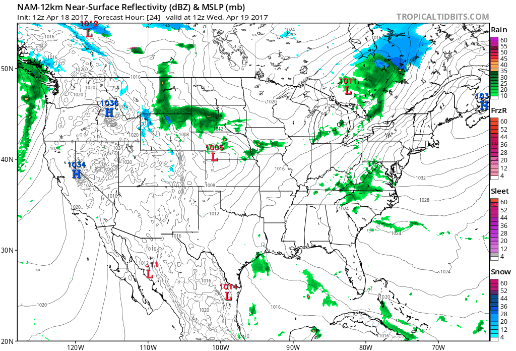
A Forecast Your Lawn Should Love. The 84-hour outlook from NOAA’s NAM model looks mostly-soggy for the northern half of the USA, with a parade of sloppy storms pushing east. Expect snow over the highest peaks of the Rockies, even some slush mixing in from the Minnesota Arrowhead into the U.P. of Michigan and far northern New England. Future Radar: NOAA and Tropicaltidbits.com.
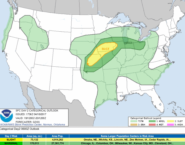
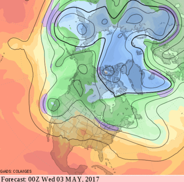
Hail & High Water. Today’s atmospheric tug-of-war plays out across the central Plains and Midwest; NOAA SPC defining a slight risk of severe weather from near Wichita, Kansas City and Omaha to Des Moines and the Quad Cities. The primary risk is large hail and damaging straight-line winds, but isolated tornadoes can’t be ruled out.
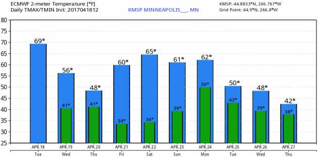
Flirting With Average. What is average anyway? The normal high is 59F, and temperatures will average close to normal looking out into next week. After a chilly, rainy Wednesday and a showery, raw Thursday temperatures recover over the weekend before another cool correction next week. MSP meteogram: WeatherBell.
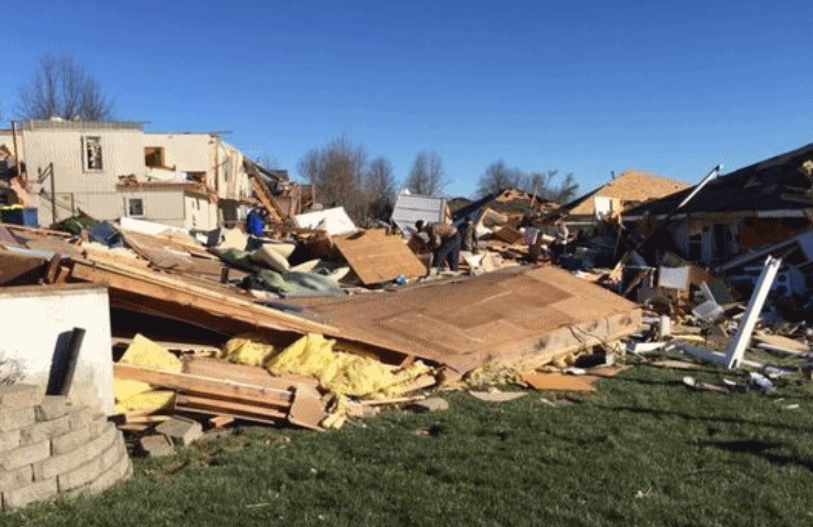
Severe Weather Myths, Misses and Misconceptions. Every spring I hear the same stuff from bright, high-functioning adults. “Tornadoes can’t hit cities or cross lakes & rivers!” Wrong. “If it’s not raining I can’t be hit by lightning.” Wrong. “It’s just “heat lightning” Paul, not a threat!” No such thing as heat lightning; it’s just lightning from a distant T-storm, too far away to hear the thunder. 554 tornadoes have already touched down in 2017 (preliminary count), on track to rival record seasons in 2011 and 2008. Fact: 44 percent of Americans killed by tornadoes since 1985 were in mobile homes. Make sure there’s a shelter nearby – consider moving to a safer location (office building or a store) when a “watch” is issued.
File photo: NOAA.
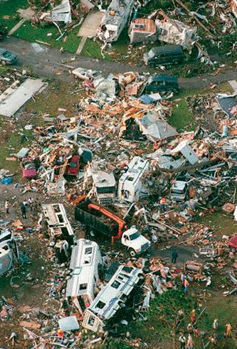
Despite Tornado Threat, Shelters Rare for Mobile Home Parks. If you live in a mobile home park built before 1988 there is no (legal) requirement for an underground shelter. Here are a couple of excerpts from Star Tribune: ” …According to the National Weather Service, 44 percent of the 1,091 Americans killed by tornadoes from 1985 to 2005 died in mobile homes, compared to 25 percent in stick-built homes. That’s especially significant considering how few Americans — 8 percent or fewer — lived in mobile homes during that period…For most of the U.S., installing storm shelters remains a voluntary decision whether they’re for a private home, a mobile home park or a community center. Alabama and Illinois have laws mandating that new public schools are built with storm shelters, and Minnesota requires shelters at mobile home parks with spaces for 10 or more homes built since 1988. The city of Wichita, Kansas, has a similar ordinance for parks built since 1994. “There have been other efforts to attempt that, but the mobile home industry and mobile home park owners have put up a lot of resistance to it,” namely citing high costs, said Laura Myers, who studies tornado disasters and responses as executive director of the Center for Advanced Public Safety at the University of Alabama...”
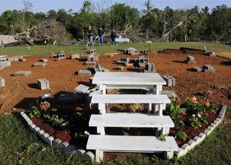
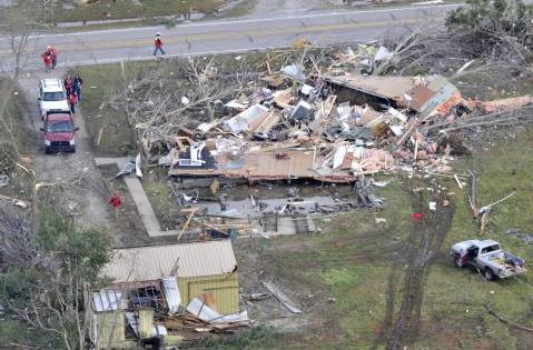
Learn More About Mobile Home Safety. KWWL.com in Waterloo, Iowa has good advice about precautions you should take if you live in manufactured housing: “A mobile home is one of the worst places to be during a tornado. Since 1991, nearly 40 percent of tornado-related deaths occurred when shelter was taken in a mobile home. With correct anchoring, federal laws require mobile homes in Iowa to withstand winds around 75 mph. But an EF-0 tornado (the lowest rating for a tornado) can create wind speeds to 85 mph. So what can you do to protect yourself if you live in a mobile home? Plan. Most severe weather days come with warning. If severe weather is anticipated, know how to get severe weather alerts and make plans if you need to evacuate. If your mobile home community offers a storm shelter, know exactly where it is located and how long it will take to get there...”
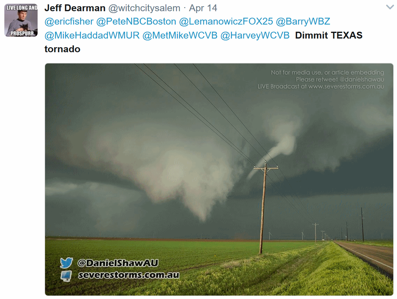
Why Rating Tornadoes Can Be Difficult in Rural Locations. Because intensity estimates are based on actual damage, and if a tornado strikes a field it’s much harder to estimate wind speeds, according to a post at Weather Underground: “A large EF3 tornado that struck near Dimmitt, Texas, last Friday illustrated the difficult task the National Weather Service sometimes faces when rating the strength of tornadoes. Tornadoes are rated from EF0 to EF5 on the Enhanced Fujita Scale based on the damage that they cause, not by their appearance or any other real-time metric. But when a tornado strikes a mostly rural area with few structures, the damage may be so sparse that it can be difficult to determine the exact strength of the winds...”
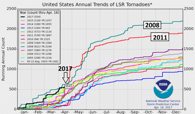
Why 2017’s Tornado Season Is Off To Such an Active Start. A story at AccuWeather.com has some good context: “With hundreds of tornado reports only four months in, 2017 could rival both 2008 and 2011 as one of the most active tornado seasons in recent history. However, as the United States’ severe weather season shifts into its climatological peak, experts agree that it might be too early to determine. “Certainly, we’re off to a really fast start, but we haven’t gotten to the big part of the season yet,” said Harold Brooks, senior research scientist at the National Oceanic and Atmospheric Administration’s (NOAA) Severe Storms Laboratory. “Half of tornadoes typically happen in May and June, so if those months end up being below normal, the year won’t be much above normal at all,” he said. Since January, the National Weather Service’s (NWS) Storm Prediction Center data shows more than 500 possible reports of tornadoes in the U.S...”
Graphic credit: NOAA SPC.
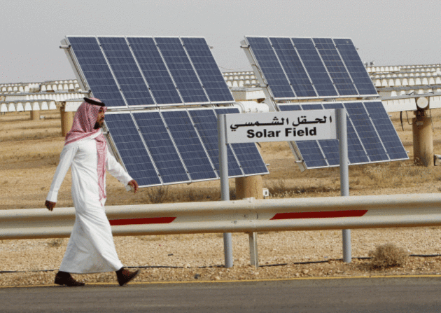
Saudis Seek Renewables Renaissance: Here’s an excerpt from Climate Nexus: “Saudi Arabia will produce 10 percent of its power, or 9.5 GW, from renewable energy by 2023, Energy Minister Khalid al-Falih said Monday. The oil superpower will funnel up to $50 billion into 30 solar and wind projects over the next six years as it seeks to diversify its economy, create jobs and wean itself off oil. Al-Falih launched a bidding round for the first 300 MW solar farm on Monday, which is expected to come online by 2019, and the kingdom will also take bids for a 400 MW wind project later this year.” (Bloomberg, Reuters, EcoWatch
File photo: Arab News.
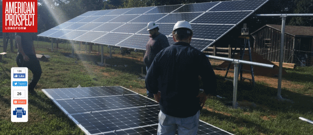
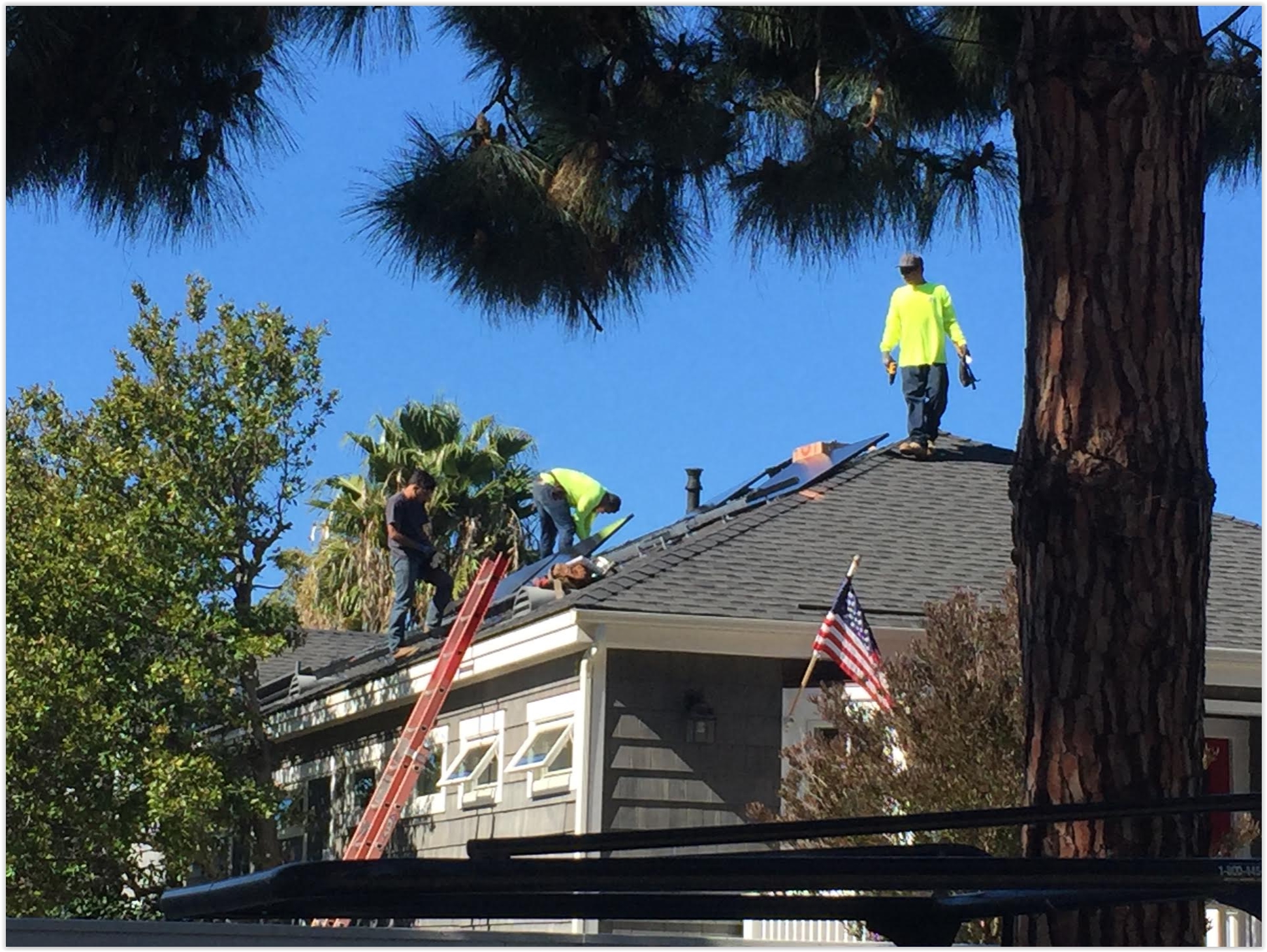
Going Solar in West Virginia. American Prospect Longform has an interesting story: “…If you’d told me I’d be working in solar, I would’ve never believed you,” Atkins says. “I always thought I’d bounce from coal job to coal job until all the mines closed and I had to leave.” Atkins is one of a small but growing number of West Virginians who’ve said goodbye to coal mining and who’ve staked their future on an industry still distinctly out of place in the state: solar power. West Virginia’s government makes no major investments in commercial solar companies, and offers no tax credits or rebates to residents who install solar panels on their homes. Indeed, state legislators have actively blocked efforts to expand the renewable energy industry. In West Virginia, where Donald Trump, promising to revive mining by slashing regulations, beat Hillary Clinton by more than 40 percentage points, coal remains king…”
How Wall Street Once Killed the U.S. Solar Industry. The Atlantic explains: “Why is the American solar-power industry so small? It’s less obvious than it may seem. The global industry is a $65-billion business, and the United States has been involved in it from the beginning. NASA first improved and perfected panels for early satellite and Apollo missions. American firms have been manufacturing and selling solar panels for 40 years. Yet North American firms produce only about 3 percent of the world’s solar panels. China and Taiwan, meanwhile, make more than 60 percent of them. Labor in East Asia is often cheaper than it is in the United States, but that’s not the only factor...”


What Sets Successful CEOs Apart. Here’s an excerpt from The Harvard Business Review: “…The behaviors we’re about to describe sound deceptively simple. But the key is to practice them with maniacal consistency, which our work reveals is a great challenge for many leaders. Deciding with speed and conviction: Legends about CEOs who always seem to know exactly how to steer their companies to wild success seem to abound in business. But we discovered that high-performing CEOs do not necessarily stand out for making great decisions all the time; rather, they stand out for being more decisive. They make decisions earlier, faster, and with greater conviction. They do so consistently—even amid ambiguity, with incomplete information, and in unfamiliar domains. In our data, people who were described as “decisive” were 12 times more likely to be high-performing CEOs…”


TODAY: Chilly, more rain arrives. Winds: NE 8-13. High: 51
WEDNESDAY NIGHT: More rain. Low: 40
THURSDAY: Showers taper, clouds linger. Chilly. Winds: N 10-15. High: near 50
FRIDAY: Partly sunny, much nicer. Winds: N 8-13. Wake-up: 38. High: near 60
SATURDAY: Some sun, nicer day of the weekend. Winds: NW 8-13. Wake-up: 40. High: 62
SUNDAY: More clouds, few showers up north. Winds: NE 8-13. Wake-up: 45. High: 59
MONDAY: Showers, risk of a T-storm. Winds: S 15-25. Wake-up: 44. High: 58
TUESDAY: Peeks of sun, a drier day. Winds: NW 10-15. Wake-up: 42. High: 55
Climate Stories….

Saturday Book Signing. I’m looking forward to my vist at the Ridgehaven Barnes and Noble in Minnetonka this upcoming Saturday, April 22, from 1-3 pm. Stop by and say hi, even if you have zero interest in my latest book, “Caring for Creation: The Evangelical’s Guide to Climate Change and a Healthy Environment.” Details here.
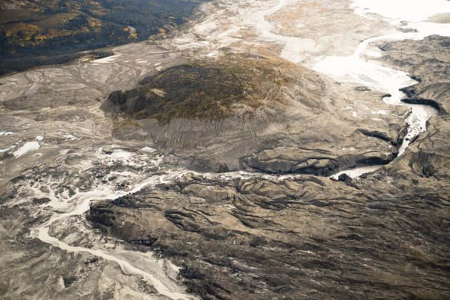
For the First Time on Record, Human-Caused Climate Change Has Rerouted an Entire River. Chris Mooney explains at The Washington Post: “A team of scientists on Monday documented what they’re describing as the first case of large-scale river reorganization as a result of human-caused climate change. They found that in mid-2016, the retreat of a very large glacier in Canada’s Yukon territory led to the rerouting of its vast stream of meltwater from one river system to another — cutting down flow to the Yukon’s largest lake, and channeling freshwater to the Pacific Ocean south of Alaska, rather than to the Bering Sea. The researchers dubbed the reorganization an act of “rapid river piracy,” saying that such events had often occurred in the Earth’s geologic past, but never before, to their knowledge, as a sudden present-day event. They also called it “geologically instantaneous…”
Photo credit: “A stream flows through the toe of Kaskawulsh Glacier in Kluane National Park in the Yukon. In 2016, this channel allowed the glacier’s meltwater to drain in a different direction than normal, resulting in the Slims River water being rerouted to a different river system.” (Dan Shugar)
Is It OK to Tinker With The Environment to Fight Climate Change? The New York Times asks the rhetorical question. Again I ask, what can possibly go wrong with hacking Earth’s climate system. Here’s an excerpt: “For the past few years, the Harvard professor David Keith has been sketching his vision: Ten Gulfstream jets, outfitted with special engines that allow them to fly safely arouund the stratosphere at an altitude of 70,000 feet, take off from a runway near the Equator. Their cargo includes thousands of pounds of a chemical compound – liquid sulfer, let’s suppose – that can be sprayed as a gas from the aircraft. It is not a one-time event; the flights take place throughout the year, dispersiing a load that amounts to 25,000 tons. If things go right, the gas converts to an aerosol of particles that remain aloft and scatter sunlight for two years. The payoff? A slowing of the earth’s warming – for as long as the Gulfstream flights continue….”
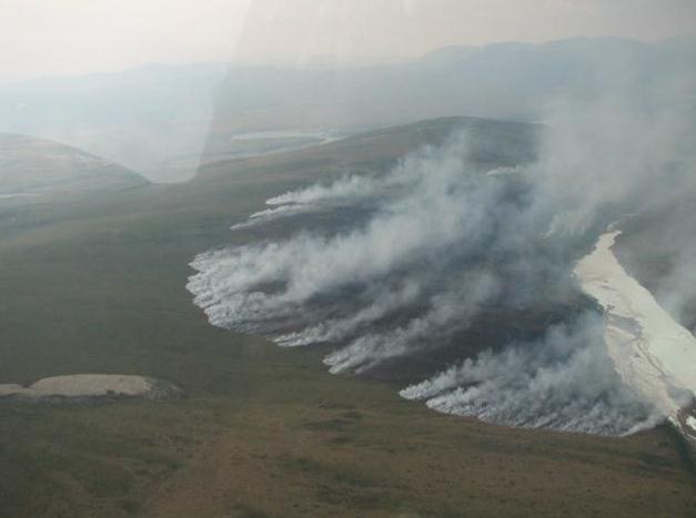
As Climate Change Fuels Wildfires, Fighting Them Must Change, Report Says. InsideClimate News has the post: “As wildfires in the American West grow larger and more frequent, strategies to manage them will have to shift radically, according to a new study. Among the researchers’ recommendations are allowing natural wildfires to burn and staging more controlled burns away from population centers. For decades, the U.S. Forest Service has battled fires by extinguishing them or by reducing dry wood that acts as fuel. But the report published Monday in Proceedings of the National Academy of Sciences concludes that because climate change is stoking bigger fires and development is placing more people in fire-prone areas, that approach has become inadequate. “We’re entering a new era of wildfires and our old tools are not going to carry us through,” said Tania Schoennagel, a research scientist at the University of Colorado at Boulder’s Institute of Arctic and Alpine Research, who co-authored the report...”
File photo: National Park Service.
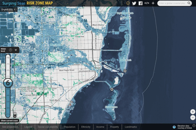
Effects of Sea Level Rise May Extend Well Inland. A migration away from the coasts here in the USA? It’s already happening in Louisiana and Alaska. Cities well inland may be impacted as coastal-dwellers throw in the towel and move, according to a new study highlighted by Andrew Freedman at Mashable: “…However, by making large swaths of the U.S. shoreline uninhabitable by the end of this century, sea level rise could reverberate far inland, too. In fact every since U.S. state will be affected by climate change-induced sea level rise, a new study found. If the global average sea level rises by 1.8 meters, or nearly 6 feet, byh 2100 – which is well within the mainstream projections from recent studies – 13.1 million Americans could migrate away from coastal areas durinng this time period, according to research published Monday in the journal Nature Climate Change…”
Image credit: “Miami under a 6-foot sea level rise scenario.” Climate Central.
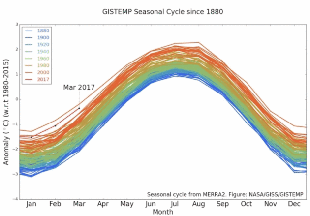
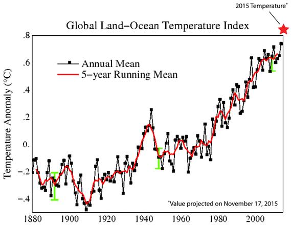
March Was Second Hottest on Record Globally. Here’s a link and story excerpt at Climate Central: “The exceptional global heat of the past few years continued last month, with March ranking as the second hottest on record for the planet. It followed the second hottest February and third hottest January, showing just how much Earth has warmed from the continued buildup of heat-trapping greenhouse gases in the atmosphere. March was 2.02°F (1.12°C) warmer than the 1951-1980 average, according to NASA data released Friday. It ranks behind only March 2016, which was 2.29°F (1.27°C) above that same average. NASA’s global temperature records extend back 137 years…”
Graphic credit: “Global temperature anomalies for each month since 1880. March 2017 was the second warmest March, behind only 2016.” Credit: NASA