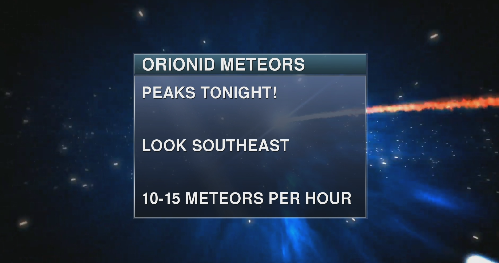
One of the year’s best meteor showers will peak this weekend between Oct. 20 and 22, when the Orionid meteor shower gets in full swing. The meteors here are some of the fastest and brightest among our meteor showers!
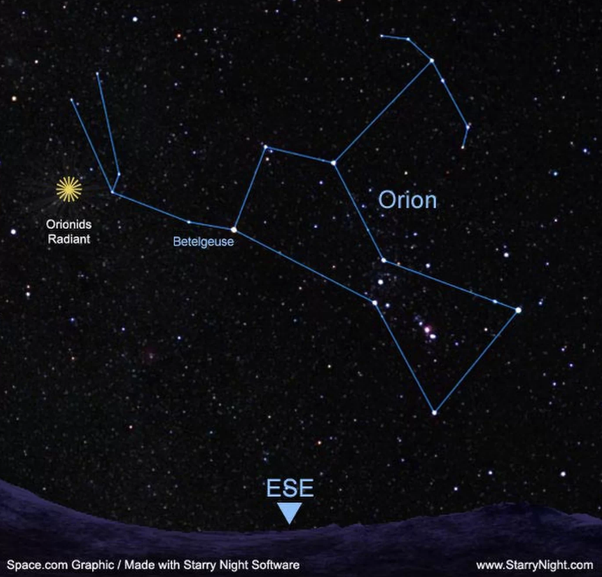
For viewing this weekend, get away from city lights and light pollution. Go out around 1:30 a.m. and let your eyes adjust to the dark for about 20 minutes. Orionid meteors are visible from anywhere on Earth and can be seen anywhere across the sky. Locate Orion the Hunter (pictured below). The meteor shower’s radiant (or point of origin) will be near Orion’s sword. Bundle up, sit back, and use only your eyes to watch the sky. Binoculars of course will not help you out.
The particles come from Halley’s Comet. This giant chunk of rock, ice, and frozen gases swings by Earth every 75ish years during it’s long orbit.
Don’t blink or you’ll miss some of ’em. Some Orionids will appear very fast and bright as those shooting stars break apart up in the atmosphere. They can whiz by at up to 148,000 mph (238,000 km/h)!
Fall Foliage Hitting Her Stride!

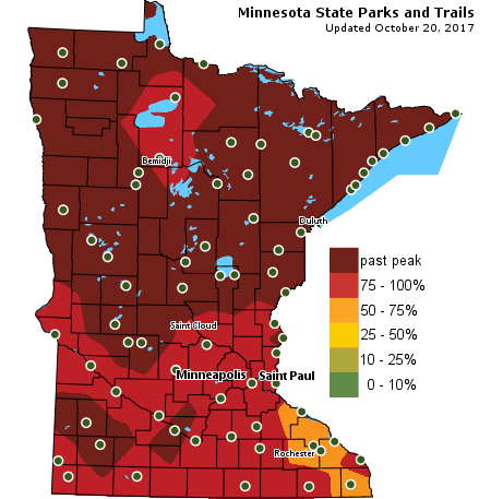
Mother Nature has been busy “lighting up” our Minnesota trees with all that gorgeous color. Those leaves certainly are pretty. At least until they fall and make us grab that rake and stuff them into all those garbage bags that look like Jack-o’-lanterns.
We in the metro had to wait a long time for those brilliant fall colors to hit peak this year. But we finally got there. Huzzah! We were about 2 weeks behind schedule. You can blame that on our wet and warm September and first half on October.
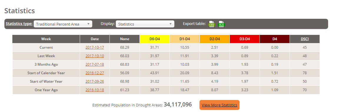
The latest USA drought update is out!
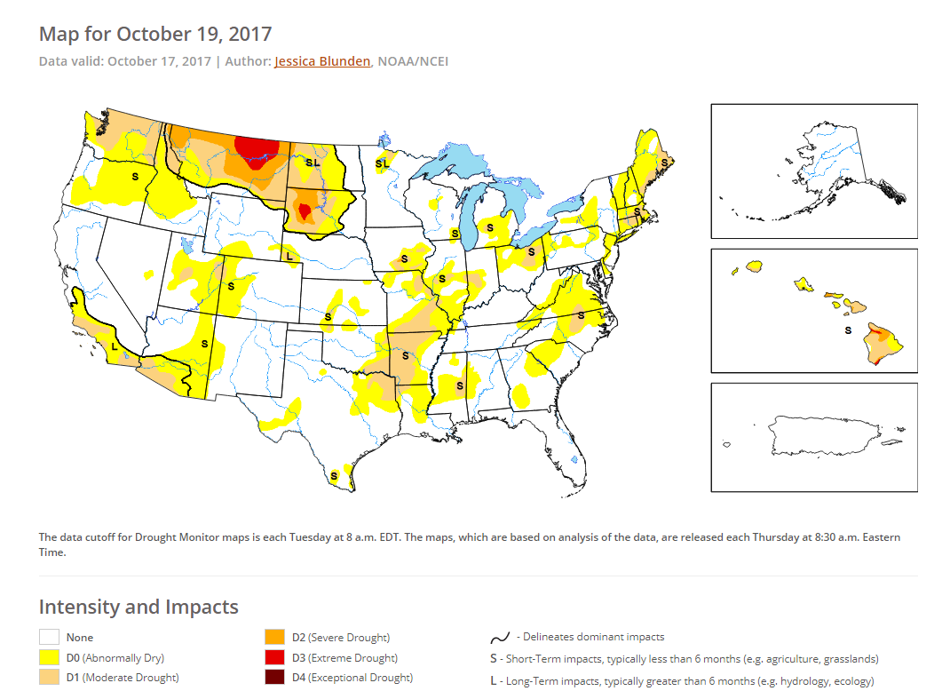
Overall… there is a “Good, Bad, and Ugly” to the latest showing from United States Drought Monitor, pictured above. The “Good” is that there is no D4 or ‘exceptional drought’ across the nation now. I’ll take that and put it in my pocket!
The “Bad” is that 13.75% of the nation is still in drought (D1 to D3). An estimated 34+ million people, including plenty of farmers live in a current drought (statistics pictured below). The “Ugly” is that extreme drought remains in portions of South Dakota, Big Sky Country of Montana, and Hawai’i.
Drought is receding from Oregon to Michigan; but emerging in Maine, Massachusetts, Connecticut, & Rhode Island, and also in portions of Arkansas, Missouri, & Texas.
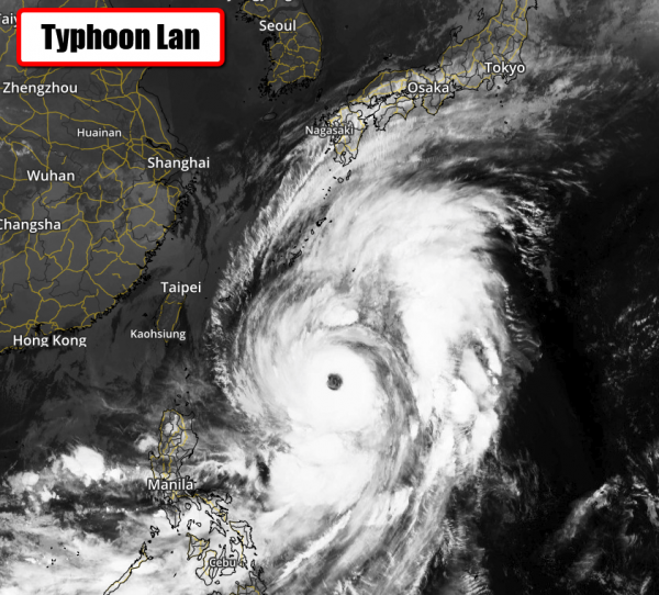
Typhoon Lan bringing impacts to Japan this weekend… may become a Super Typhoon.
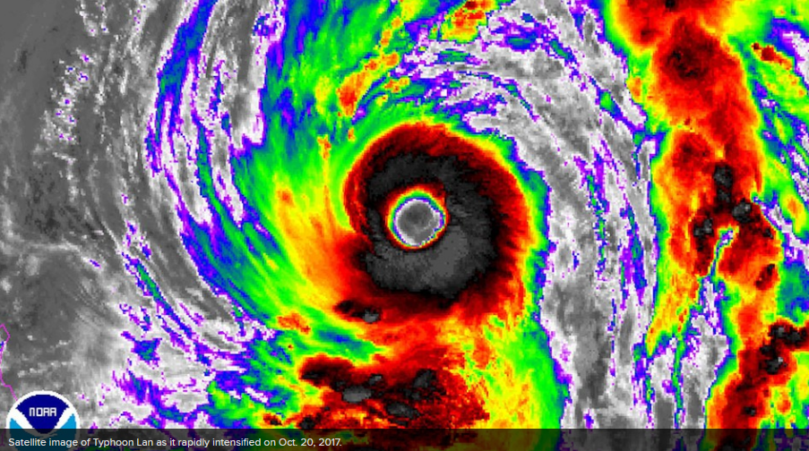
Typhoon Lan is the strongest storm on the planet on Friday with sustained winds of 115 mph. The eye of the storm is massive. It’s just about 50 miles in diameter (pictured in infrared satellite imagery above and below)!
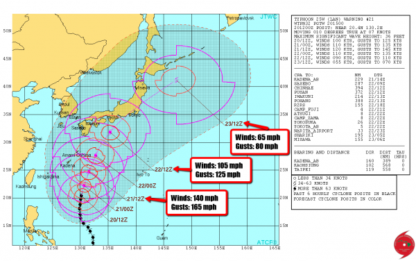
As of Friday, Lan was still sitting over the open water of the western Pacific, between the Philippines and southern China. It was traveling north at around 8 mph.
Conditions appear favorable for further strengthening. Typhoon Lan is forecast to move to the north-northeast during the next few days, reaching peak intensity sometime early in the weekend. The forecast of 140 mph winds on Saturday would make it an equivalent category 4 hurricane, and close to Super Typhoon status.
Lan is also forecasted to then weaken a bit as it runs over cooler ocean waters and strong upper level winds (wind shear) as it works closer to Japan. But Japan will be watching for impacts that include: dangerously high surf, damaging winds, heavy rainfall (a half-a-foot to a foot of rain is possible in areas), and potential power outages, especially along the southern coast.
– Meteorologist Joe Hansel
Stay classy, fellow weather nerds. Follow me on Facebook & Twitter.